|
search place name
|
||
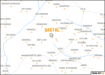
Qasţal (Ḩalab, Syria)Qasţal is a town in the Ḩalab region of Syria. An overview map of the region around Qasţal is displayed below.
regional and 3d topo map of Qasţal, Syria ::
Qasţal airports ::
The nearest airport is ALP - Aleppo Intl, located 53.5 km south of Qasţal.
Other airports nearby include GZT - Gaziantep Oguzeli (54.0 km north east), ADA - Adana Incirlik Ab (147.8 km west), ADA - Adana (159.8 km west), LTK - Latakia Bassel Al Assad Intl (167.2 km south west), Nearby towns ::
Qunţul (1.2km south east) //
Ma‘arrīn (1.7km south east) //
Dīkmah Ţāsh (3.4km north) //
Yāzī Bāgh (3.6km north east) //
Bafliyūn (3.5km south west) //
‘Arab Wīrān (4.9km north west) //
Demirışık (5.4km north) //
A‘zāz (5.4km south east) //
Sījarāz (6.3km south) //
Akçabağlar (5.9km north east) //
Şūdjī (5.6km east) //
Shamanlī (6.3km west) //
Öncüpınar (6.4km east) //
Qaţmah (7.0km south west) //
Dayr Şawwān (8.1km north) //
Qaşşarjah (6.8km east) //
Naddah (8.3km south east) //
Shawārighat al Jawz (9.5km south west) //
Kafr Kalbīn (10.6km south east) //
[all distances 'as the bird flies' and approximate] 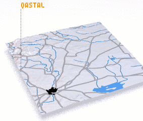 Places with similar names to Qasţal, Syria ::
Disclaimer :: Information on this page comes without warranty of any kind |
||
|
Where is Qasţal? Elevation and coordinates ::
Latitude (lat): 36°37'57"N Longitude (lon): 37°1'3"E
Elevation (approx.): 683m (map arrows pan, magnifying glasses zoom) |
||
|
Visiting Qasţal? Hotel/Accommodation ::
Book a hotel in Qasţal Travel Guide ::
Buy a travel guide for Syria rental cars ::
car rental offers GPS waypoint ::
download a GPX waypoint (PoI) of Qasţal for your GPS receiver
|
||