|
search place name
|
||
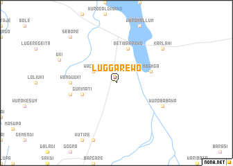
Luggarewo (Gongola, Nigeria)Luggarewo is a town in the Gongola region of Nigeria. An overview map of the region around Luggarewo is displayed below.
regional and 3d topo map of Luggarewo, Nigeria ::
Luggarewo airports ::
The nearest airport is YOL - Yola, located 33.3 km north west of Luggarewo.
Other airports nearby include GOU - Garoua (85.2 km east), NGE - N'gaoundere Ngaoundere (212.4 km south east), MVR - Maroua Salak (234.8 km north east), Nearby towns ::
Waccuje (4.1km north west) //
Beti Bappawo (5.9km north) //
Mbamga (5.8km east) //
Guri Nati (5.8km west) //
Wendu Uki (7.3km west) //
Dorodi (7.6km west) //
Wuro Babawa (8.2km south east) //
Karlahi (9.2km north east) //
Sebore (10.4km north west) //
[all distances 'as the bird flies' and approximate] 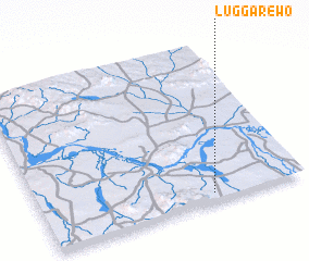
Disclaimer :: Information on this page comes without warranty of any kind |
||
|
Where is Luggarewo? Elevation and coordinates ::
Latitude (lat): 9°3'0"N Longitude (lon): 12°39'0"E
Elevation (approx.): 198m (map arrows pan, magnifying glasses zoom) |
||
|
Visiting Luggarewo? Hotel/Accommodation ::
Book a hotel in Luggarewo Travel Guide ::
Buy a travel guide for Nigeria rental cars ::
car rental offers GPS waypoint ::
download a GPX waypoint (PoI) of Luggarewo for your GPS receiver
|
||