|
search place name
|
||
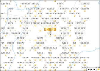
Ohoro (Gongola, Nigeria)Ohoro is a town in the Gongola region of Nigeria. An overview map of the region around Ohoro is displayed below.
regional and 3d topo map of Ohoro, Nigeria ::
Ohoro airports ::
The nearest airport is ILR - Ilorin, located 23.0 km south east of Ohoro.
Other airports nearby include IBA - Ibadan (145.7 km south), AKR - Akure (182.2 km south east), Nearby towns ::
Alapa (0.0km north) //
Olori (1.9km north) //
Idi Agbon Alagbede (1.8km west) //
Okubiyi (1.8km west) //
Pasa Lamba (1.8km east) //
Iletitun (2.6km south west) //
Oniyeye (2.6km south east) //
Ajimasin (2.6km south east) //
Kondoro Alagbede (3.7km north) //
Oke Nipete (3.7km east) //
Alagangan (4.1km north west) //
Budo Bale (4.1km north east) //
Idi Apa (4.1km south west) //
Barano (4.1km north east) //
Ponpola (4.1km south east) //
Ologede (5.2km south west) //
Agbono (5.2km south west) //
Adeogun (5.2km south east) //
Abule Alagbede (5.6km south) //
Agbono Kekere (5.6km south) //
Alakuko (5.5km east) //
Sangote (5.8km east) //
Aseseru (5.9km north) //
Iyano Igbeti (5.8km east) //
Alusekere (5.8km west) //
Agbati Obinu Kekere (5.8km west) //
Bangbose (5.9km north) //
Arobadi (5.9km north) //
Onigbase (5.9km north) //
[all distances 'as the bird flies' and approximate] 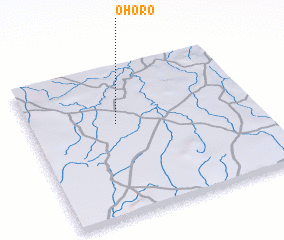 Places with similar names to Ohoro, Nigeria ::
Disclaimer :: Information on this page comes without warranty of any kind |
||
|
Where is Ohoro? Elevation and coordinates ::
Latitude (lat): 8°37'0"N Longitude (lon): 4°23'0"E
Elevation (approx.): 359m (map arrows pan, magnifying glasses zoom) |
||
|
Visiting Ohoro? Hotel/Accommodation ::
Book a hotel in Ohoro Travel Guide ::
Buy a travel guide for Nigeria rental cars ::
car rental offers GPS waypoint ::
download a GPX waypoint (PoI) of Ohoro for your GPS receiver
|
||