|
search place name
|
||
Chang-dong (Kangwŏn, Korea, North)Chang-dong is a town in the Kangwŏn region of Korea, North. An overview map of the region around Chang-dong is displayed below.
regional and 3d topo map of Chang-dong, Korea, North ::

Chang-dong airports ::
The nearest airport is SHO - Sokch'o Sokcho, located 83.6 km south east of Chang-dong.
Other airports nearby include KAG - Kangnung Gangneung (135.5 km south east), SSN - Seoul East Seoul Ab (148.5 km south west), GMP - Seoul Gimpo (153.3 km south west), OSN - Osan Ab (187.4 km south west), Nearby towns ::
Chappanmal (0.5km west) //
Chinda-ri (0.8km south west) //
Tut'ae-dong (1.4km north) //
Ch'ŏngjŏng-ni (1.5km south west) //
Sin'gyo-ri (2.1km north) //
Ssanggyep'yŏng-ni (2.2km north west) //
Segu-ri (2.2km north west) //
Sinŭm-ni (2.7km north east) //
Sangjŏmbang-ni (2.6km north west) //
Kwangdong-ni (3.0km east) //
Puldang-dong (3.5km south east) //
Majŏndong-ni (3.7km north east) //
Sŏngdong-ni (4.1km north) //
Honggadŏk (3.6km east) //
Changal-li (4.6km south east) //
Kanbalgo-ri (4.8km south) //
Songdunji (5.4km south) //
Chagŭn-gol (5.0km south west) //
Sambau-gol (4.5km west) //
Soksadong-ni (4.8km south west) //
Yunp'o-dong (4.9km south east) //
Munjang-gol (6.0km south) //
Ch'omok-kol (4.8km east) //
Torŭng (6.1km north) //
P'ungmi-ri (6.2km north) //
Kanchŏmbang-ni (4.9km west) //
Sanwŏl-li (4.9km west) //
K'ŭn-gol (5.3km south west) //
Koksal-li (5.0km west) //
[all distances 'as the bird flies' and approximate] 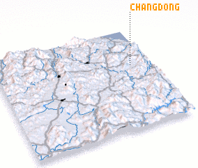 Places with similar names to Chang-dong, Korea, North ::
// Shangdang (MM)
// Chingtang (IN)
// Ch'ang-dong (KP)
// Ch'ang-dong (KP)
// Ch'ang-dong (KP)
// Ch'ang-dong (KP)
// Ch'ang-dong (KP)
// Ch'ang-dong (KP)
// Ch'ang-dong (KP)
// Ch'ang-dong (KP)
Disclaimer :: Information on this page comes without warranty of any kind |
||
|
Where is Chang-dong? Elevation and coordinates ::
Latitude (lat): 38°38'20"N Longitude (lon): 127°52'44"E
Elevation (approx.): 689m (map arrows pan, magnifying glasses zoom) |
||
|
Visiting Chang-dong? Hotel/Accommodation ::
Book a hotel in Chang-dong Travel Guide ::
rental cars ::
car rental offers GPS waypoint ::
download a GPX waypoint (PoI) of Chang-dong for your GPS receiver
|
||