|
search place name
|
||
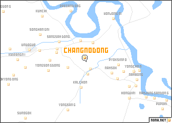
Changno-dong (Najin Sŏnbong-si, Korea, North)Changno-dong is a town in the Najin Sŏnbong-si region of Korea, North. An overview map of the region around Changno-dong is displayed below.
regional and 3d topo map of Changno-dong, Korea, North ::
Changno-dong airports ::
The nearest airport is VVO - Vladivostok Knevichi, located 171.0 km north east of Changno-dong.
Nearby towns ::
Hahoe-ri (1.7km south east) //
Ch'ŏnghak-tong (2.8km south) //
Osong (3.2km south west) //
Yangp'yŏng-dong (4.2km north) //
Hayŏp'yŏng-ni (4.6km north) //
Kalchŏn (5.7km south) //
Namsŏk (4.9km south east) //
Haksong-ni (5.1km north west) //
Aoji-ri (5.4km north west) //
Pyŏksinp'o (5.3km east) //
Sangsam-dong (6.1km north west) //
Sahoe-ri (6.3km south east) //
T'aeyang-ni (5.8km west) //
Yongsŏng-dong (6.4km west) //
Sinhŭngch'ŏn (6.5km east) //
[all distances 'as the bird flies' and approximate] 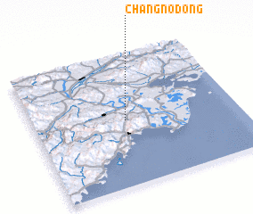 Places with similar names to Changno-dong, Korea, North ::
// Changni-dong (KP)
// Chongno-dong (KP)
// Ch'ŏngun-dong (KP)
// Chunggan-dong (KP)
// Chungni-dong (KP)
// Chungŭn-dong (KP)
// Changan-dong (KR)
// Chŏngnae-dong (KR)
// Ch'ŏngun-dong (KR)
// Ch'ŏngun-dong (KR)
Disclaimer :: Information on this page comes without warranty of any kind |
||
|
Where is Changno-dong? Elevation and coordinates ::
Latitude (lat): 42°29'41"N Longitude (lon): 130°27'8"E
Elevation (approx.): 76m (map arrows pan, magnifying glasses zoom) |
||
|
Visiting Changno-dong? Hotel/Accommodation ::
Book a hotel in Changno-dong Travel Guide ::
rental cars ::
car rental offers GPS waypoint ::
download a GPX waypoint (PoI) of Changno-dong for your GPS receiver
|
||