|
search place name
|
||
Hŭllip-ch'on (Hamgyŏng, Korea, North)Hŭllip-ch'on is a town in the Hamgyŏng region of Korea, North. An overview map of the region around Hŭllip-ch'on is displayed below.
regional and 3d topo map of Hŭllip-ch'on, Korea, North ::

Nearby towns ::
Indong-ni (1.4km south) //
Samgang-ch'on (1.2km south west) //
Chungdong-ni (1.9km north east) //
Paek-kol (2.3km north east) //
Ŏin-dong (2.0km north east) //
Killi-dong (2.5km north) //
Chunghŭng-ch'on (2.1km west) //
Samgi-ri (3.5km south) //
Korip (3.3km south west) //
Indong-ni (3.1km north west) //
Ch'ŏnp'yŏng (3.8km south) //
Hahamjŏn (3.6km south west) //
Yŏngdae (4.5km south) //
Chejung-ni (4.8km north east) //
Kasan-ch'on (4.3km north west) //
Sanghamjŏn (4.3km west) //
Sangnop'yŏng (5.7km south) //
Harop'yŏng (6.2km south) //
Changsaeng-ch'on (6.2km north) //
Kasan-ch'on (5.5km north west) //
Hŭngni-ch'on (5.2km west) //
Chiktong-ni (7.0km north) //
Koyang-dong (6.8km south) //
Top'yŏng (7.1km south) //
Tongjung-ni (7.2km south) //
Susŏ-ri (7.6km south) //
Changhŭng-ni (8.0km south) //
Samnyŏng (6.8km south east) //
Songjŏn-ch'on (6.3km west) //
[all distances 'as the bird flies' and approximate] 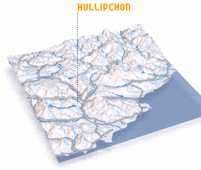 Places with similar names to Hŭllip-ch'on, Korea, North :: Disclaimer :: Information on this page comes without warranty of any kind |
||
|
Where is Hŭllip-ch'on? Elevation and coordinates ::
Latitude (lat): 40°28'40"N Longitude (lon): 128°17'36"E
Elevation (approx.): 271m (map arrows pan, magnifying glasses zoom) |
||
|
Visiting Hŭllip-ch'on? Hotel/Accommodation ::
Book a hotel in Hŭllip-ch'on Travel Guide ::
rental cars ::
car rental offers GPS waypoint ::
download a GPX waypoint (PoI) of Hŭllip-ch'on for your GPS receiver
|
||