|
search place name
|
||
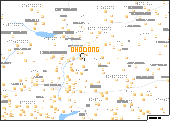
Ŏho-dong (P'yŏngan, Korea, North)Ŏho-dong is a town in the P'yŏngan region of Korea, North. An overview map of the region around Ŏho-dong is displayed below.
regional and 3d topo map of Ŏho-dong, Korea, North ::
Ŏho-dong airports ::
The nearest airport is FNJ - Pyongyang Intl, located 66.2 km south east of Ŏho-dong.
Nearby towns ::
So-dong (0.8km north west) //
Il-li (1.3km north) //
Ansim-dong (1.3km south) //
Sinal-li (1.5km north) //
Tap-tong (1.9km west) //
Tokchang-dong (2.7km north) //
Taesan (3.0km south) //
Anhŭng-dong (2.4km west) //
Tapsang-ni (2.9km north west) //
Tapha-ri (2.7km north west) //
Chu-gol (2.6km east) //
Hyŏnam (2.7km south west) //
Kŭmsong (3.2km south west) //
Yangjich'on (2.7km west) //
Kongsim-dong (3.5km north) //
Sinp'ung (3.0km south west) //
Taesong-ni (3.1km south west) //
Hadan (3.0km east) //
Ŏhang (3.7km south east) //
Oryu-dong (4.3km north west) //
Oeso-ri (4.6km south) //
Sinjŏng-ni (4.7km north) //
Pangch'on (3.8km west) //
Yongdŭng-ni (4.2km south east) //
Soam-dong (4.0km west) //
Songjŏng-dong (4.7km south west) //
Sŏso-ri (5.1km south) //
Su-dong (4.1km east) //
Tongso-ri (5.3km north) //
[all distances 'as the bird flies' and approximate]  Places with similar names to Ŏho-dong, Korea, North ::
Disclaimer :: Information on this page comes without warranty of any kind |
||
|
Where is Ŏho-dong? Elevation and coordinates ::
Latitude (lat): 39°44'9"N Longitude (lon): 125°16'32"E
Elevation (approx.): 70m (map arrows pan, magnifying glasses zoom) |
||
|
Visiting Ŏho-dong? Hotel/Accommodation ::
Book a hotel in Ŏho-dong Travel Guide ::
rental cars ::
car rental offers GPS waypoint ::
download a GPX waypoint (PoI) of Ŏho-dong for your GPS receiver
|
||