|
search place name
|
||
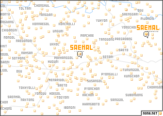
Sae-mal (P'yŏngyang, Korea, North)Sae-mal is a town in the P'yŏngyang region of Korea, North. An overview map of the region around Sae-mal is displayed below.
regional and 3d topo map of Sae-mal, Korea, North ::
Sae-mal airports ::
The nearest airport is FNJ - Pyongyang Intl, located 56.3 km north west of Sae-mal.
Other airports nearby include GMP - Seoul Gimpo (156.3 km south), SSN - Seoul East Seoul Ab (179.7 km south east), OSN - Osan Ab (212.3 km south), Nearby towns ::
Ppael-gol (0.7km west) //
Twi-gol (1.0km north west) //
Hwajŏl-li (1.2km east) //
Siksong-ni (1.4km east) //
Chŏng-ch'on (1.6km east) //
Paebau (1.8km south east) //
Najŏl-li (2.2km north) //
Kwijang-gol (2.0km south east) //
Simgŭnsol (1.9km east) //
Uttang-gol (2.3km south) //
Mulmi (2.2km south east) //
Toeji-gol (2.2km south west) //
Sasul-gol (2.5km south) //
Chikhyŏl-li (2.1km south west) //
Ha-dong (2.5km north east) //
Sin-ch'on (2.7km north) //
Ch'ŏn-dong (3.0km north) //
Manŭlme (3.0km north) //
Hwasŏng-gol (2.6km east) //
Mŏkpangi (3.0km south west) //
Tonggu-ri (3.3km south east) //
Yo-dong (3.0km north east) //
Saek-kol (3.1km north west) //
Tokchang (3.7km south) //
Nae-dong (3.1km south east) //
Songjŏl-li (3.8km north) //
Mugoji (3.5km south east) //
Yongbau (3.4km north east) //
Tunjaeul (3.5km south west) //
[all distances 'as the bird flies' and approximate] 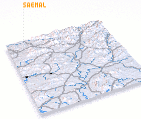 Places with similar names to Sae-mal, Korea, North ::
Disclaimer :: Information on this page comes without warranty of any kind |
||
|
Where is Sae-mal? Elevation and coordinates ::
Latitude (lat): 38°52'1"N Longitude (lon): 126°7'56"E
Elevation (approx.): 88m (map arrows pan, magnifying glasses zoom) |
||
|
Visiting Sae-mal? Hotel/Accommodation ::
Book a hotel in Sae-mal Travel Guide ::
rental cars ::
car rental offers GPS waypoint ::
download a GPX waypoint (PoI) of Sae-mal for your GPS receiver
|
||