|
search place name
|
||
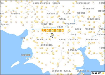
Ssangbong (Korea, North)Ssangbong is a town in Korea, North. An overview map of the region around Ssangbong is displayed below.
regional and 3d topo map of Ssangbong, Korea, North ::
Ssangbong airports ::
The nearest airport is FNJ - Pyongyang Intl, located 108.6 km south east of Ssangbong.
Nearby towns ::
Tongsep'yŏng (0.7km east) //
Yŏnsu-ri (1.0km south west) //
Chŏngbong (1.9km north) //
Kach'isan (1.9km north) //
Wŏnsep'yŏng-ni (1.7km north east) //
Sin-dong (2.1km north west) //
Namgok (2.3km north east) //
Ch'udong (2.3km north east) //
Yonghŭng (2.3km south west) //
Kŭmp'yŏng (2.3km north west) //
Kasal-li (2.7km north west) //
Sŏch'u (3.5km north) //
Inhwa (3.7km south) //
Hwach'ŏn (2.8km west) //
Tŏkpong (2.8km west) //
Ch'ŏlsan-ŭp (3.4km south east) //
Tongam (3.4km north east) //
Munbong-ni (3.3km north west) //
Pubong (3.4km south east) //
Chang-dong (4.0km south) //
Changhŭng (4.0km south) //
Choyang-dong (3.4km north east) //
Todŏk-tong (4.0km north) //
Changhyŏn (3.4km south west) //
Sinmin (3.5km north east) //
Kabong-nodongjagu (3.9km north east) //
Sŏnju-ri (4.8km south) //
To-dong (4.5km north west) //
Yŏngan (4.7km south) //
[all distances 'as the bird flies' and approximate]  Places with similar names to Ssangbong, Korea, North ::
// Sangbanga (BJ)
// Sungaibaung (ID)
// Sungaibaung (ID)
// Sungaibunga (ID)
// Sangobong (KP)
// Songbong (KP)
// Sangbong (KR)
// Sangbong (KR)
// Songbang (KR)
// Sŭngbang (KR)
Disclaimer :: Information on this page comes without warranty of any kind |
||
|
Where is Ssangbong? Elevation and coordinates ::
Latitude (lat): 39°48'0"N Longitude (lon): 124°39'0"E
Elevation (approx.): 73m (map arrows pan, magnifying glasses zoom) |
||
|
Visiting Ssangbong? Hotel/Accommodation ::
Book a hotel in Ssangbong Travel Guide ::
rental cars ::
car rental offers GPS waypoint ::
download a GPX waypoint (PoI) of Ssangbong for your GPS receiver
|
||