|
search place name
|
||
Kiwajim-mal (Kangwŏn, Korea, South)Kiwajim-mal is a town in the Kangwŏn region of Korea, South. An overview map of the region around Kiwajim-mal is displayed below.
regional and 3d topo map of Kiwajim-mal, Korea, South ::

Kiwajim-mal airports ::
The nearest airport is SHO - Sokch'o Sokcho, located 72.4 km north east of Kiwajim-mal.
Other airports nearby include SSN - Seoul East Seoul Ab (79.7 km south west), KAG - Kangnung Gangneung (91.3 km east), GMP - Seoul Gimpo (101.8 km west), OSN - Osan Ab (109.6 km south west), Nearby towns ::
Musut'ŏ (0.9km south east) //
Saet'ŏ (2.5km north) //
Nont'ŭl-mal (3.0km south) //
Yongt'aeul (3.2km south west) //
Sinnae (3.8km north) //
Taegoryŏng (4.2km south) //
Tŏkpatchae (5.1km north west) //
Sinnae (5.4km south east) //
Kal-gol (6.2km south west) //
Sarang-ch'on (5.3km west) //
Sarang-mal (5.6km north west) //
Sŏngsan (5.7km south east) //
Sŏng-dong (6.0km south west) //
Koyak-kol (7.3km north) //
Chŏm-mal (7.1km south east) //
Kong-gol (7.3km north west) //
Han'gye (7.4km east) //
Wa-ch'on (8.7km south east) //
Pusawŏl-li (8.3km south west) //
Ch'odang-mal (10.4km north west) //
[all distances 'as the bird flies' and approximate] 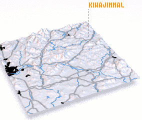 Places with similar names to Kiwajim-mal, Korea, South :: Disclaimer :: Information on this page comes without warranty of any kind |
||
|
Where is Kiwajim-mal? Elevation and coordinates ::
Latitude (lat): 37°47'15"N Longitude (lon): 127°54'28"E
Elevation (approx.): 261m (map arrows pan, magnifying glasses zoom) |
||
|
Visiting Kiwajim-mal? Hotel/Accommodation ::
Book a hotel in Kiwajim-mal Travel Guide ::
rental cars ::
car rental offers GPS waypoint ::
download a GPX waypoint (PoI) of Kiwajim-mal for your GPS receiver
|
||