|
search place name
|
||
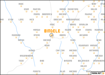
Bindele (Equatorial Guinea)Bindele is a town in Equatorial Guinea. An overview map of the region around Bindele is displayed below.
regional and 3d topo map of Bindele, Equatorial Guinea ::
Bindele airports ::
The nearest airport is BMM - Bitam, located 49.5 km north east of Bindele.
Other airports nearby include OYE - Oyem (64.4 km south east), BSG - Bata (144.1 km west), YAO - Yaounde Ville (222.8 km north), LBV - Libreville Leon M Ba (244.0 km south west), Nearby towns ::
Mbarangun (0.0km north) //
Macomo (2.6km south west) //
Nsoc (3.7km north) //
Abang (3.7km east) //
Avam (4.1km north east) //
Agua (4.1km south west) //
Mfene (5.6km west) //
Mangui (5.9km west) //
Ngumo (5.9km east) //
Ebo (5.9km east) //
Cam (5.9km south) //
Obocuin (5.9km north) //
Cam (6.7km south east) //
Masama (6.7km north east) //
Oboroncu (7.6km north) //
Angoc (7.6km north) //
Eves (7.6km north) //
Eves (7.6km east) //
Abenelang (8.3km north west) //
Macomo (8.3km north east) //
Abang (8.3km north east) //
Nsang (9.3km north west) //
Atud (9.3km south west) //
Mvomo (9.3km south west) //
Mico (9.3km north west) //
Macomo (9.3km south east) //
Mongomo-Ngoc (9.3km north east) //
Mbum (9.3km north east) //
Andom (10.5km south west) //
[all distances 'as the bird flies' and approximate] 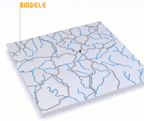 Places with similar names to Bindele, Equatorial Guinea ::
Disclaimer :: Information on this page comes without warranty of any kind |
||
|
Where is Bindele? Elevation and coordinates ::
Latitude (lat): 1°52'0"N Longitude (lon): 11°6'0"E
Elevation (approx.): 622m (map arrows pan, magnifying glasses zoom) |
||
|
Visiting Bindele? Hotel/Accommodation ::
Book a hotel in Bindele Travel Guide ::
rental cars ::
car rental offers GPS waypoint ::
download a GPX waypoint (PoI) of Bindele for your GPS receiver
|
||