|
search place name
|
||
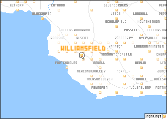
Williamsfield (Saint Elizabeth, Jamaica)Williamsfield is a town in the Saint Elizabeth region of Jamaica. An overview map of the region around Williamsfield is displayed below.
regional and 3d topo map of Williamsfield, Jamaica ::
Williamsfield airports ::
The nearest airport is MBJ - Montego Bay Sangster Intl, located 65.0 km north of Williamsfield.
Other airports nearby include OCJ - Ocho Rios Boscobel (99.2 km north east), KTP - Kingston Tinson Pen (100.1 km east), KIN - Kingston Norman Manley Intl (103.7 km east), POT - Port Antonio Ken Jones (133.7 km east), Nearby towns ::
Watchwell (NaNkm north) //
Barbary Hall (1.9km north) //
Success (1.8km east) //
Hopewell (2.6km north west) //
Far Enough (2.6km north east) //
Browns Valley (3.7km north) //
Winchester (3.7km north) //
Alscot (3.7km north) //
Geneva (3.5km east) //
Fort Charles (4.0km south west) //
White Rock (4.0km north west) //
Newcombe Valley (4.1km south east) //
Brucefield (4.1km north west) //
Newell (4.0km south east) //
Claremont Park (4.0km south east) //
Mountain Side (4.1km north east) //
Paradise (4.1km north east) //
Kildare (4.1km north east) //
Malvern Well (4.0km north east) //
Little Park (5.1km south east) //
Johns Lodge (5.1km north east) //
Fullerswood Park (5.8km north) //
Hill Top (5.6km west) //
Bideford (5.6km east) //
Smithfield (5.6km west) //
Manchioneal (5.8km south) //
Fullerswood (6.6km north west) //
Pond Side (6.5km north west) //
Iver Cottage (6.5km north east) //
[all distances 'as the bird flies' and approximate] 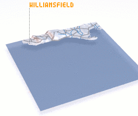 Places with similar names to Williamsfield, Jamaica ::
// Williamsfield (US)
// Willmsfeld (DE)
// Williamsfield (US)
// Williamsfield (JM)
// Williamsfield (JM)
// Williamsfield (JM)
// Williamsfield (JM)
// Williamsfield (JM)
// Williamsfield (JM)
// Williamsfield (JM)
Disclaimer :: Information on this page comes without warranty of any kind |
||
|
Where is Williamsfield? Elevation and coordinates ::
Latitude (lat): 17°56'0"N Longitude (lon): 77°46'0"W
Elevation (approx.): 86m (map arrows pan, magnifying glasses zoom) |
||
|
Visiting Williamsfield? Hotel/Accommodation ::
Book a hotel in Williamsfield Travel Guide ::
Buy a travel guide for Jamaica rental cars ::
car rental offers GPS waypoint ::
download a GPX waypoint (PoI) of Williamsfield for your GPS receiver
|
||