|
search place name
|
||
A Mour (3) (Laos)A Mour (3) is a town in Laos. An overview map of the region around A Mour (3) is displayed below.
regional and 3d topo map of A Mour (3), Laos ::

A Mour (3) airports ::
The nearest airport is DAD - Danang Intl, located 155.2 km east of A Mour (3).
Other airports nearby include PKZ - Pakse (172.3 km south west), Nearby towns ::
A Mour (2) (1.8km east) //
A Mour (1) (2.6km north east) //
A Shap (1) (4.0km north east) //
A Shap (2) (4.0km north east) //
Tavouac (5) (6.6km south west) //
A Trup (1) (6.5km north east) //
A Tain (6.5km south east) //
A Trup (3) (6.6km north east) //
Tavouac (2) (7.4km south) //
Trouan (2) (7.6km north) //
Tavouac (1) (7.6km south) //
A Tsin (7.7km south east) //
Shei Shou Koum (8.2km north west) //
Shei Griao (8.2km north west) //
Samouay (8.2km north east) //
Ta Rong (8.2km north east) //
Shei Giao (9.0km north west) //
La Mân (2) (9.1km north west) //
Tan Koal (9.0km north east) //
Meo (9.0km south east) //
Tavouac (9.1km south west) //
[all distances 'as the bird flies' and approximate] 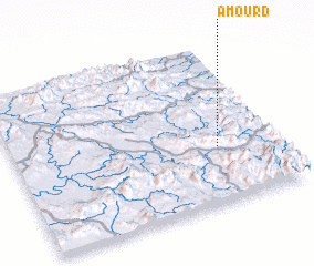 Places with similar names to A Mour (3), Laos ::
// Amerete (BO)
// Ammeroid (AT)
// Aia Murata (IT)
// Amarito (CU)
// Amarat (TR)
// Amárita (ES)
// Ambaiorata (MG)
// Amīr Deh (IR)
// Amīr Rūd (IR)
// Amiret (US)
Disclaimer :: Information on this page comes without warranty of any kind |
||
|
Where is A Mour (3)? Elevation and coordinates ::
Latitude (lat): 16°21'0"N Longitude (lon): 106°47'0"E
Elevation (approx.): 439m (map arrows pan, magnifying glasses zoom) |
||
|
Visiting A Mour (3)? Hotel/Accommodation ::
Book a hotel in A Mour (3) Travel Guide ::
Buy a travel guide for Laos rental cars ::
car rental offers GPS waypoint ::
download a GPX waypoint (PoI) of A Mour (3) for your GPS receiver
|
||