|
search place name
|
||
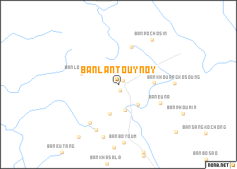
Ban Lantouy-Noy (Phôngsali, Laos)Ban Lantouy-Noy is a town in the Phôngsali region of Laos. An overview map of the region around Ban Lantouy-Noy is displayed below.
regional and 3d topo map of Ban Lantouy-Noy, Laos ::
Ban Lantouy-Noy airports ::
The nearest airport is THL - Tachilek Tachileik, located 285.1 km south west of Ban Lantouy-Noy.
Nearby towns ::
Ban Lantouy-Gnai (0.9km north east) //
Séochai (0.9km south) //
Ban Xiangséo (4.1km south) //
Ban Souantèng (4.2km south east) //
Ban Houayping (4.8km south) //
Ban Longtang (5.2km east) //
Ban Lopouhô (5.7km west) //
Ban Léngsuchai (6.3km north) //
Ban Euna (6.8km south east) //
Ban Lusanmô (1) (7.3km south west) //
Ban Lusanmô (2) (7.9km south west) //
Ban Nalusang (8.5km south) //
Ban Khouangkosoung (8.1km east) //
Ban Pochosin (8.6km north east) //
Ban Khaokheuching (10.1km south west) //
[all distances 'as the bird flies' and approximate] 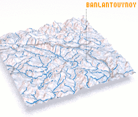 Places with similar names to Ban Lantouy-Noy, Laos ::
// Bonlanden (DE)
// Bonlanden (DE)
// Ban Lantèn (LA)
// Ban Lantèn (LA)
// Ban Lan Tene (LA)
// Ban Lontan (LA)
Disclaimer :: Information on this page comes without warranty of any kind |
||
|
Where is Ban Lantouy-Noy? Elevation and coordinates ::
Latitude (lat): 22°26'2"N Longitude (lon): 101°43'55"E
Elevation (approx.): 907m (map arrows pan, magnifying glasses zoom) |
||
|
Visiting Ban Lantouy-Noy? Hotel/Accommodation ::
Book a hotel in Ban Lantouy-Noy Travel Guide ::
Buy a travel guide for Laos rental cars ::
car rental offers GPS waypoint ::
download a GPX waypoint (PoI) of Ban Lantouy-Noy for your GPS receiver
|
||