|
search place name
|
||
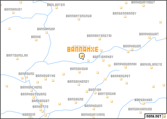
Ban Namxè (Oudômxai, Laos)Ban Namxè is a town in the Oudômxai region of Laos. An overview map of the region around Ban Namxè is displayed below.
regional and 3d topo map of Ban Namxè, Laos ::
Ban Namxè airports ::
The nearest airport is LPQ - Luang Prabang Luang Phabang Intl, located 116.0 km south east of Ban Namxè.
Other airports nearby include THL - Tachilek Tachileik (170.5 km west), KET - Kengtung (206.8 km west), Nearby towns ::
Ban Môkkalam (1.1km east) //
Ban Phoula (2.1km north) //
Ban Sakoua (3.0km south) //
Ban Pangkhoay (4.3km south east) //
Ban Houayha (4.2km north east) //
Ban Tiom Phay (4.2km east) //
Ban Chompalong (5.3km south west) //
Ban Sakho Noy (5.8km south) //
Ban Namtong-Tai (5.7km north east) //
Ban Môknamtôn (5.6km east) //
Ban Panglèng (6.4km south east) //
Ban Tao (7.3km south) //
Ban Tiom (8.0km south) //
Ban Phoupat (8.0km south west) //
Ban Houayhè (9.1km south west) //
Ban Pangpot (9.1km south east) //
Ban Tôngha (9.9km south east) //
Ban Samsôp (9.9km north west) //
[all distances 'as the bird flies' and approximate]  Places with similar names to Ban Namxè, Laos ::
// Ban Mae Ka Sa (TH)
// Ban Mae Kasa (TH)
// Ban Mae Kasae (TH)
// Ban Mixai (LA)
// Ban Môksô (LA)
// Ban Môksoy (LA)
// Ban Namxa (LA)
// Ban Namxao (LA)
// Ban Namxao (LA)
// Ban Namxè (LA)
Disclaimer :: Information on this page comes without warranty of any kind |
||
|
Where is Ban Namxè? Elevation and coordinates ::
Latitude (lat): 20°46'6"N Longitude (lon): 101°32'34"E
Elevation (approx.): 539m (map arrows pan, magnifying glasses zoom) |
||
|
Visiting Ban Namxè? Hotel/Accommodation ::
Book a hotel in Ban Namxè Travel Guide ::
Buy a travel guide for Laos rental cars ::
car rental offers GPS waypoint ::
download a GPX waypoint (PoI) of Ban Namxè for your GPS receiver
|
||