|
search place name
|
||
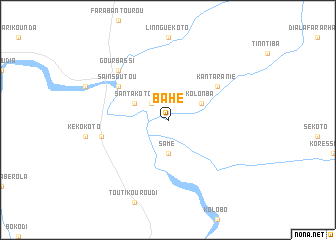
Bahé (Mali)Bahé is a town in Mali. An overview map of the region around Bahé is displayed below.
regional and 3d topo map of Bahé, Mali ::
Bahé airports ::
The nearest airport is KGG - Kedougou, located 110.4 km south west of Bahé.
Other airports nearby include KYS - Kayes Dag Dag (126.6 km north), BXE - Bakel (191.2 km north west), SEY - Selibabi Selibady (213.3 km north), Nearby towns ::
Fatié (2.6km north west) //
Samé (3.7km south) //
Kolonba (4.1km north east) //
Santakoto (4.1km north west) //
Kantaranié (6.6km north east) //
Saïnsoutou (6.6km north west) //
Kassaguéri (7.4km west) //
Gourbassi (7.8km north west) //
[all distances 'as the bird flies' and approximate] 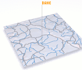 Places with similar names to Bahé, Mali ::
Disclaimer :: Information on this page comes without warranty of any kind |
||
|
Where is Bahé? Elevation and coordinates ::
Latitude (lat): 13°21'0"N Longitude (lon): 11°35'0"W
Elevation (approx.): 87m (map arrows pan, magnifying glasses zoom) |
||
|
Visiting Bahé? Hotel/Accommodation ::
Book a hotel in Bahé Travel Guide ::
Buy a travel guide for Mali rental cars ::
car rental offers GPS waypoint ::
download a GPX waypoint (PoI) of Bahé for your GPS receiver
|
||