|
search place name
|
||
Chamane (Mozambique)Chamane is a town in Mozambique. An overview map of the region around Chamane is displayed below.
regional and 3d topo map of Chamane, Mozambique ::

Chamane airports ::
The nearest airport is SZK - Skukuza, located 75.5 km north west of Chamane.
Other airports nearby include MPM - Maputo (80.4 km south), HDS - Hoedspruit Afb (157.1 km north west), MTS - Manzini Matsapha (171.2 km south west), PHW - Phalaborwa (183.9 km north west), Nearby towns ::
Gondê (0.9km south east) //
Spembane (1.7km north) //
Mugalde (1.9km north) //
Buto (2.1km east) //
João (2.5km south west) //
Incomanine (2.9km east) //
Oloeo (2.9km south west) //
Glaze (3.8km south east) //
Dongue (4.1km north west) //
Jetemana (3.8km north west) //
Gocha (4.2km west) //
Languana (4.5km south east) //
Mendes (4.7km south west) //
Xihoana Tumbo (4.7km north east) //
Majudine (5.0km east) //
Gabaza (5.2km west) //
Niquice (5.4km west) //
Martins (5.9km west) //
Assune (6.2km north east) //
Medingana (6.2km north west) //
Amessala (6.5km north west) //
Jijimbana (6.5km south west) //
Malholhuana (6.7km south east) //
Uasquete (7.4km north) //
Cossa (7.0km west) //
Aluzana (7.0km west) //
Sábiè (7.8km south) //
Mugamune (7.7km south east) //
Mongoli (7.7km north west) //
[all distances 'as the bird flies' and approximate] 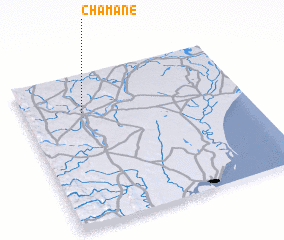 Places with similar names to Chamane, Mozambique ::
Disclaimer :: Information on this page comes without warranty of any kind |
||
|
Where is Chamane? Elevation and coordinates ::
Latitude (lat): 25°15'0"S Longitude (lon): 32°16'0"E
Elevation (approx.): 71m (map arrows pan, magnifying glasses zoom) |
||
|
Visiting Chamane? Hotel/Accommodation ::
Book a hotel in Chamane Travel Guide ::
Buy a travel guide for Mozambique rental cars ::
car rental offers GPS waypoint ::
download a GPX waypoint (PoI) of Chamane for your GPS receiver
|
||