|
search place name
|
||
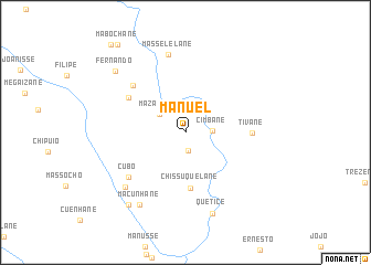
Manuel (Gaza, Mozambique)Manuel is a town in the Gaza region of Mozambique. An overview map of the region around Manuel is displayed below.
regional and 3d topo map of Manuel, Mozambique ::
Manuel airports ::
The nearest airport is INH - Inhambane, located 156.8 km east of Manuel.
Other airports nearby include VNX - Vilankulu Vilankulo (220.3 km north east), Nearby towns ::
Catine (1.8km south) //
Cimbane (2.6km east) //
Mazaicane (3.0km north west) //
Chissuquelane (5.6km south) //
Tivane (6.1km east) //
Jossefa (6.3km north west) //
Chibombane (6.8km north west) //
Cubo (6.9km south west) //
Masselelane (8.0km north) //
Macandze (7.8km south west) //
Macunhane (8.4km south west) //
Quétice (8.6km south) //
Duzenta (9.0km south west) //
Fernando (8.9km north west) //
Mabochane (10.8km north west) //
Chuele (11.2km north west) //
[all distances 'as the bird flies' and approximate] 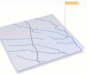 Places with similar names to Manuel, Mozambique ::
Disclaimer :: Information on this page comes without warranty of any kind |
||
|
Where is Manuel? Elevation and coordinates ::
Latitude (lat): 23°31'46"S Longitude (lon): 33°55'4"E
Elevation (approx.): 51m (map arrows pan, magnifying glasses zoom) |
||
|
Visiting Manuel? Hotel/Accommodation ::
Book a hotel in Manuel Travel Guide ::
Buy a travel guide for Mozambique rental cars ::
car rental offers GPS waypoint ::
download a GPX waypoint (PoI) of Manuel for your GPS receiver
|
||