|
search place name
|
||
Nozoagala (Maputo, Mozambique)Nozoagala is a town in the Maputo region of Mozambique. An overview map of the region around Nozoagala is displayed below.
regional and 3d topo map of Nozoagala, Mozambique ::

Nozoagala airports ::
The nearest airport is MPM - Maputo, located 99.8 km north of Nozoagala.
Other airports nearby include MTS - Manzini Matsapha (107.4 km west), ULD - Ulundi Prince Mangosuthu Buthelezi (192.0 km south west), RCB - Richard's Bay Richards Bay (216.7 km south), SZK - Skukuza (217.1 km north), Nearby towns ::
Bebelhane (2.2km north east) //
Chefe P. Tembe (2.3km north) //
Mabuana (2.4km north east) //
Muguelha (3.2km north east) //
Mabisa (6.1km south) //
Gimo (7.1km north) //
Komankobolo (7.2km south west) //
Catuane (7.3km south west) //
[all distances 'as the bird flies' and approximate] 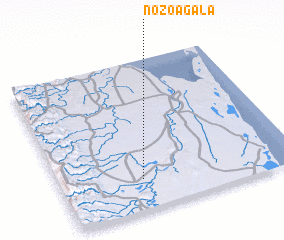 Places with similar names to Nozoagala, Mozambique ::
// Nuschlau (CH)
// Nasikelo (ZM)
// Nsokolo (ZM)
// Nīāzqolī (IR)
// Niāze Kili (PK)
// Niāz Gul (PK)
// NiāzKili (PK)
// Nasekula (FJ)
// Niassagala (GN)
// Nociglia (IT)
Disclaimer :: Information on this page comes without warranty of any kind |
||
|
Where is Nozoagala? Elevation and coordinates ::
Latitude (lat): 26°47'53"S Longitude (lon): 32°20'37"E
Elevation (approx.): 41m (map arrows pan, magnifying glasses zoom) |
||
|
Visiting Nozoagala? Hotel/Accommodation ::
Book a hotel in Nozoagala Travel Guide ::
Buy a travel guide for Mozambique rental cars ::
car rental offers GPS waypoint ::
download a GPX waypoint (PoI) of Nozoagala for your GPS receiver
|
||