|
search place name
|
||
Warabale (Bay, Somalia)Warabale is a town in the Bay region of Somalia. An overview map of the region around Warabale is displayed below.
regional and 3d topo map of Warabale, Somalia ::

Nearby towns ::
Danbar (1.9km west) //
Gorey (1.9km south) //
Maroodile (2.6km south west) //
Galweel (2.6km north east) //
Dabeylow (3.7km west) //
Isha (4.1km south west) //
Nasib (4.1km south west) //
Aikijedi (4.1km south west) //
Yaqle (4.1km north west) //
Gaal Somaal (4.1km north west) //
Asha Gab (4.1km north west) //
Udgashan (5.2km south west) //
War Calanle (5.6km west) //
Matuuti (5.6km north) //
Cumarow Maddow (5.9km north) //
Halule (5.9km south) //
Waranle (5.9km south) //
Gaalsomale (5.9km west) //
Buulohilowle (5.9km west) //
Dheere (5.9km south) //
Casha-Gaabo Hubeyrad (5.9km north) //
Xasno-Yusuf (6.7km south west) //
Koban Kow Kow (6.7km north west) //
Isha (6.7km south west) //
Waryaryoyi (6.7km north west) //
Garmagal (6.7km north west) //
Manaur (6.7km south east) //
Gubadi (7.4km west) //
Gof Caddey (7.4km west) //
[all distances 'as the bird flies' and approximate] 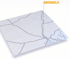 Places with similar names to Warabale, Somalia ::
// Warbelow (DE)
// Werbelow (DE)
// Wirbelau (DE)
// Warabol (SD)
// Waraabaley (SO)
// Waraabalow (SO)
// Waraaboole (SO)
// Werabēlē (ET)
// Werabeley (ET)
// Waraabaley (SO)
Disclaimer :: Information on this page comes without warranty of any kind |
||
|
Where is Warabale? Elevation and coordinates ::
Latitude (lat): 3°14'0"N Longitude (lon): 43°38'0"E
Elevation (approx.): 495m (map arrows pan, magnifying glasses zoom) |
||
|
Visiting Warabale? Hotel/Accommodation ::
Book a hotel in Warabale Travel Guide ::
Buy a travel guide for Somalia rental cars ::
car rental offers GPS waypoint ::
download a GPX waypoint (PoI) of Warabale for your GPS receiver
|
||