|
search place name
|
||
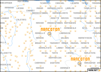
Nan Coton (Nord-Ouest, Haiti)Nan Coton is a town in the Nord-Ouest region of Haiti. An overview map of the region around Nan Coton is displayed below.
regional and 3d topo map of Nan Coton, Haiti ::
Nan Coton airports ::
The nearest airport is CAP - Cap Haitien Intl, located 79.5 km east of Nan Coton.
Other airports nearby include IGA - Matthew Town (150.1 km north west), PAP - Port-au-prince Toussaint Louverture Intl (151.7 km south east), BCA - Baracoa Playa Gustavo Rizo (174.4 km west), MOA - Moa Orestes Acosta (226.7 km north west), Nearby towns ::
La Carrière (0.0km north) //
Gonde (0.0km north) //
Moustique (1.9km north) //
Dupin (2.5km north west) //
Fond Ti Bonheur (2.5km north east) //
Zeb à Flèche (2.5km north east) //
Bas Mahotière (2.5km south west) //
Plaine Alsene (2.5km south west) //
Mombelle (3.5km west) //
Mahotière (3.5km west) //
Nan Mansolme (3.7km north) //
Nan Cocoye (3.7km north) //
Nan Coucou (3.7km south) //
Cléante (3.7km south) //
Beau Champ (3.9km north west) //
Morne Foucault (3.9km north west) //
Nan Aimé (3.9km south west) //
Passe Catabois (4.1km north east) //
Toussaint (4.1km south east) //
Fond Dubois (4.1km south west) //
Colombier (4.1km south east) //
Savane Mare (3.9km north east) //
Arcahaie (3.9km north east) //
Bombay (3.9km south east) //
Larode (3.9km south east) //
Faisson (5.1km north west) //
Manvion (5.1km north west) //
Baguette (5.1km south west) //
Grand Fond Ti Noël (5.1km south west) //
[all distances 'as the bird flies' and approximate] 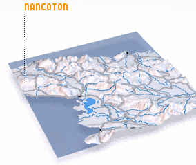 Places with similar names to Nan Coton, Haiti ::
// Nawng-ten (MM)
// Nawngtön (MM)
// Nawngtun (MM)
// Nanga Tuan (ID)
// Nengué Dioni (GA)
// Nan Coton (HT)
// Nan Coton (HT)
// Nan Coton (HT)
// Nan Coton (HT)
// Nan Coton (HT)
Disclaimer :: Information on this page comes without warranty of any kind |
||
|
Where is Nan Coton? Elevation and coordinates ::
Latitude (lat): 19°48'0"N Longitude (lon): 72°57'0"W
Elevation (approx.): 208m (map arrows pan, magnifying glasses zoom) |
||
|
Visiting Nan Coton? Hotel/Accommodation ::
Book a hotel in Nan Coton Travel Guide ::
Buy a travel guide for Haiti rental cars ::
car rental offers GPS waypoint ::
download a GPX waypoint (PoI) of Nan Coton for your GPS receiver
|
||