|
search place name
|
||
Kandegama (North Central, Sri Lanka)Kandegama is a town in the North Central region of Sri Lanka. An overview map of the region around Kandegama is displayed below.
regional and 3d topo map of Kandegama, Sri Lanka ::

Kandegama airports ::
The nearest airport is TRR - Trinciomalee China Bay, located 99.4 km north east of Kandegama.
Other airports nearby include CMB - Bandaranaike Intl Colombo (109.4 km south west), RML - Colombo Ratmalana (142.8 km south west), GOY - Galoya Amparai (143.8 km south east), JAF - Jaffna Kankesanturai (207.1 km north), Nearby towns ::
Galegoda Kumbukwewa (0.3km west) //
Sakalasuriyagama (0.3km west) //
Madatungama (0.3km west) //
Negama (1.7km north) //
Helambawewa (1.8km south) //
Werunkulama (1.9km north) //
Niyangama (1.9km north) //
Medtungama (1.9km north) //
Uda Negama (2.1km west) //
Nanwattegama (2.4km south east) //
Diyabetiyagama (2.4km north east) //
Kandulegama (2.8km south west) //
Walpalugama (2.8km south west) //
Ihala Palugollewa (2.8km north west) //
Pahala Palugollewa (2.8km north west) //
Kimbulagala (3.4km east) //
Pahalagama (3.4km east) //
Galketiyagama (3.4km east) //
Wedenigama (3.4km east) //
Bamunugama (3.4km east) //
Thalakolawewa (3.6km south) //
Ambagaswewa (3.7km south) //
Ulpothagama (3.7km south) //
Kadurugaswewa (3.7km south) //
Negampaha (3.7km north west) //
Ihalagama (3.7km north) //
Siyambalewa (3.9km south east) //
Aliyamalagala (3.9km south east) //
Nelliyagama (3.9km north east) //
[all distances 'as the bird flies' and approximate] 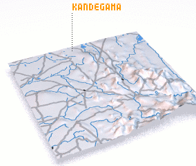 Places with similar names to Kandegama, Sri Lanka ::
// Candigum (PH)
// Canduao Gamay (PH)
// Canticum (PH)
// Gounou Dogom (TD)
// Kandegama (LK)
// Kandegama (LK)
// Kandegama (LK)
// Kandegama (LK)
// Kandegama (LK)
// Kandegama (LK)
Disclaimer :: Information on this page comes without warranty of any kind |
||
|
Where is Kandegama? Elevation and coordinates ::
Latitude (lat): 7°57'59"N Longitude (lon): 80°29'9"E
Elevation (approx.): 151m (map arrows pan, magnifying glasses zoom) |
||
|
Visiting Kandegama? Hotel/Accommodation ::
Book a hotel in Kandegama Travel Guide ::
Buy a travel guide for Sri Lanka rental cars ::
car rental offers GPS waypoint ::
download a GPX waypoint (PoI) of Kandegama for your GPS receiver
|
||