|
search place name
|
||
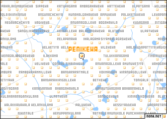
Penikewa (North Central, Sri Lanka)Penikewa is a town in the North Central region of Sri Lanka. An overview map of the region around Penikewa is displayed below.
regional and 3d topo map of Penikewa, Sri Lanka ::
Penikewa airports ::
The nearest airport is TRR - Trinciomalee China Bay, located 62.7 km east of Penikewa.
Other airports nearby include JAF - Jaffna Kankesanturai (158.5 km north), CMB - Bandaranaike Intl Colombo (163.6 km south west), GOY - Galoya Amparai (167.3 km south east), RML - Colombo Ratmalana (198.9 km south west), Nearby towns ::
Weddewa (1.9km north) //
Aluwaketuwala (1.8km east) //
Konakumbukwewa (1.8km east) //
Messalewa (1.8km east) //
Kapiriggama (1.9km south) //
Katukeliyawa (1.9km south) //
Ehetuwagama (1.8km west) //
Andarawewa (1.8km west) //
Galkadawala (2.6km north east) //
Kendewa (2.6km north west) //
Diwulgahawewa (2.6km north west) //
Alutgama (2.6km south east) //
Timbiriwewa (2.6km south west) //
Pinogama (3.7km east) //
Mayilagammana (3.7km east) //
Kadiyawa (3.7km east) //
Siyambalagaswewa (3.7km west) //
Ihalagama (4.1km north east) //
Siyambalagaswewa (4.1km north east) //
Ihala Kolongaswewa (4.1km north east) //
Palu Gonumeriyawa (4.1km north east) //
Kulankattiwewa (4.1km north west) //
Kahatagahawewa (4.1km north west) //
Galkandegama (4.1km north west) //
Kuda Galkandegama (4.1km north west) //
Kahatagollewa (4.1km south east) //
Moragahawala (4.1km south east) //
Welewa (4.1km north west) //
Poradutugama (4.1km north west) //
[all distances 'as the bird flies' and approximate] 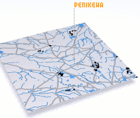 Places with similar names to Penikewa, Sri Lanka ::
Disclaimer :: Information on this page comes without warranty of any kind |
||
|
Where is Penikewa? Elevation and coordinates ::
Latitude (lat): 8°28'0"N Longitude (lon): 80°37'0"E
Elevation (approx.): 114m (map arrows pan, magnifying glasses zoom) |
||
|
Visiting Penikewa? Hotel/Accommodation ::
Book a hotel in Penikewa Travel Guide ::
Buy a travel guide for Sri Lanka rental cars ::
car rental offers GPS waypoint ::
download a GPX waypoint (PoI) of Penikewa for your GPS receiver
|
||