|
search place name
|
||
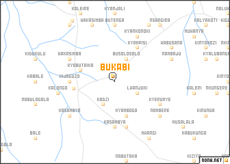
Bukabi (Busoga, Uganda)Bukabi is a town in the Busoga region of Uganda. An overview map of the region around Bukabi is displayed below.
regional and 3d topo map of Bukabi, Uganda ::
Bukabi airports ::
The nearest airport is EBB - Entebbe Intl, located 113.6 km south of Bukabi.
Other airports nearby include SRT - Soroti (143.2 km north east), Nearby towns ::
Busolosolo (4.1km north east) //
Lwanjuki (4.1km south east) //
Kadzi (4.1km south west) //
Kyambogo (5.9km south) //
Kyabutaika (5.9km west) //
Kyampisi (6.7km north east) //
Kakoge (6.8km west) //
Kijaguzo (7.4km west) //
Kasambya (7.4km south) //
Kabusinde (7.6km south) //
Kyankonoki (8.3km north east) //
Kyerumye (8.3km south east) //
Wakasimba (8.3km north west) //
Nambere (9.3km south east) //
Kasambya (9.3km south west) //
[all distances 'as the bird flies' and approximate] 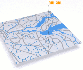 Places with similar names to Bukabi, Uganda ::
Disclaimer :: Information on this page comes without warranty of any kind |
||
|
Where is Bukabi? Elevation and coordinates ::
Latitude (lat): 1°4'0"N Longitude (lon): 32°31'0"E
Elevation (approx.): 1072m (map arrows pan, magnifying glasses zoom) |
||
|
Visiting Bukabi? Hotel/Accommodation ::
Book a hotel in Bukabi Travel Guide ::
Buy a travel guide for Uganda rental cars ::
car rental offers GPS waypoint ::
download a GPX waypoint (PoI) of Bukabi for your GPS receiver
|
||