|
search place name
|
||
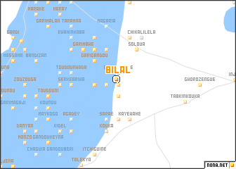
Bilal (Niamey, Niger)Bilal is a town in the Niamey region of Niger. An overview map of the region around Bilal is displayed below.
regional and 3d topo map of Bilal, Niger ::
Bilal airports ::
The nearest airport is NIM - Niamey Diori Hamani, located 155.8 km south west of Bilal.
Other airports nearby include THZ - Tahoua (211.8 km east), SKO - Sokoto Sadiq Abubakar Iii Intl (237.7 km south east), Nearby towns ::
Bilal Doutchi (0.0km north) //
Wagou (1.9km south) //
Adohi (1.9km south) //
Fouda Guiéza (1.8km west) //
Chikal Kwaré (1.9km north) //
Dourougouna (3.6km west) //
Gari Gandou (5.2km north west) //
I-n-Takachi (5.6km south) //
Reyrabanza (5.6km south) //
Saraé (5.8km south) //
Doumaloha (5.8km north) //
Kayé Wahé (5.8km south) //
Soloua (6.2km north east) //
Gari Mayaki (6.6km north west) //
Serké Ariwa (7.2km west) //
Danyan (7.2km west) //
Djamoun (7.2km west) //
Kouka (7.6km south) //
Toudoun Wada (7.4km west) //
Chikal Chaniassou (7.6km north) //
Chikal Dourgouna (7.6km north) //
Garim Bwé (7.7km north west) //
Gari Agui (8.2km north west) //
Chikal Iléla (8.2km north east) //
Agadey (9.1km south west) //
Gari Irkwénon (9.1km north west) //
Danyaé (10.3km south west) //
Rwahinkaba (10.3km north west) //
[all distances 'as the bird flies' and approximate] 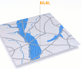 Places with similar names to Bilal, Niger ::
Disclaimer :: Information on this page comes without warranty of any kind |
||
|
Where is Bilal? Elevation and coordinates ::
Latitude (lat): 14°11'0"N Longitude (lon): 3°26'0"E
Elevation (approx.): 220m (map arrows pan, magnifying glasses zoom) |
||
|
Visiting Bilal? Hotel/Accommodation ::
Book a hotel in Bilal Travel Guide ::
Buy a travel guide for Niger rental cars ::
car rental offers GPS waypoint ::
download a GPX waypoint (PoI) of Bilal for your GPS receiver
|
||