|
search place name
|
||
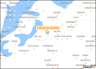
Kawou Kowou (Dosso, Niger)Kawou Kowou is a town in the Dosso region of Niger. An overview map of the region around Kawou Kowou is displayed below.
regional and 3d topo map of Kawou Kowou, Niger ::
Kawou Kowou airports ::
The nearest airport is SKO - Sokoto Sadiq Abubakar Iii Intl, located 129.3 km east of Kawou Kowou.
Other airports nearby include NIM - Niamey Diori Hamani (209.4 km west), THZ - Tahoua (258.5 km north east), Nearby towns ::
Tounga Dintaway (2.6km north west) //
Galewa (3.6km east) //
Timtimi (4.1km south east) //
Angoal Magazi (4.1km north east) //
Ballam (4.1km south west) //
Tambo Boka (5.6km south) //
Guidadamé (5.8km north) //
Hawachaka (5.7km east) //
Gwarnani (5.7km east) //
Rendema (6.6km north east) //
Madawachi (7.6km south) //
Gwalumahe (7.5km east) //
Kotolougui (7.8km south west) //
Sangori (8.2km north east) //
May Zari (9.1km north west) //
Tounga Mohamadou (9.1km north west) //
Toudawa (9.1km north west) //
Tounga Goubé (10.4km north west) //
[all distances 'as the bird flies' and approximate] 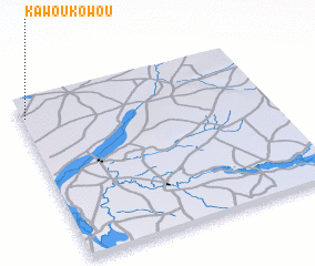 Places with similar names to Kawou Kowou, Niger ::
// Cawa-Cawa (PH)
// Gawaygaway (PH)
// Gawaygaway (PH)
// KwaCawu (ZA)
// Kawakawa (NZ)
// Kawakwa (CD)
// Kwi Kwi (SD)
// Gwagwa (NG)
// Gwegwe (NG)
// Kwakwa (NG)
Disclaimer :: Information on this page comes without warranty of any kind |
||
|
Where is Kawou Kowou? Elevation and coordinates ::
Latitude (lat): 12°53'0"N Longitude (lon): 4°1'0"E
Elevation (approx.): 240m (map arrows pan, magnifying glasses zoom) |
||
|
Visiting Kawou Kowou? Hotel/Accommodation ::
Book a hotel in Kawou Kowou Travel Guide ::
Buy a travel guide for Niger rental cars ::
car rental offers GPS waypoint ::
download a GPX waypoint (PoI) of Kawou Kowou for your GPS receiver
|
||