|
search place name
|
||
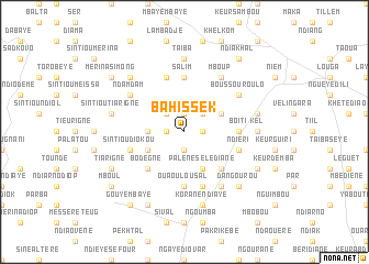
Bahis Sek (Louga, Senegal)Bahis Sek is a town in the Louga region of Senegal. An overview map of the region around Bahis Sek is displayed below.
regional and 3d topo map of Bahis Sek, Senegal ::
Bahis Sek airports ::
The nearest airport is XLS - St. Louis Saint Louis, located 54.9 km north of Bahis Sek.
Other airports nearby include DKR - Dakar Leopold Sedar Senghor Intl (152.9 km south west), KLC - Kaolack (160.4 km south), Nearby towns ::
Kourtara (1.9km north) //
Ngaraf (1.8km west) //
Merina Dia (1.9km south) //
Nguène (1.8km east) //
Badar Ndaye (2.6km north west) //
Sam Sek (2.6km north east) //
Dialgane Guedji (3.6km west) //
Nguèyène (4.0km north east) //
Darou Fal (4.0km south west) //
Palène Sélédiane (4.1km south east) //
Bodègne (5.1km south west) //
Bidem (5.1km south east) //
Salim (5.6km north) //
Ouaoulou Sal (5.6km south) //
Kara (5.4km east) //
Boiti (5.4km east) //
Sintiou Diokou (5.7km west) //
Khelkom (5.8km north) //
Ndiéri (5.7km east) //
Kourou (5.8km south) //
Badar Diaye (5.8km south) //
Ndam Dam (6.5km north west) //
Boussourou Lo (6.5km north east) //
Mboup (6.6km north east) //
Dara (6.6km south east) //
Taïba (7.4km north) //
Kel (7.1km east) //
Sintiou Tiarigne (7.4km west) //
Ndam Gott (7.4km east) //
[all distances 'as the bird flies' and approximate] 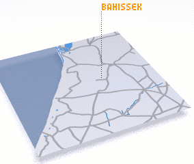 Places with similar names to Bahis Sek, Senegal ::
// Bhuschi (BD)
Disclaimer :: Information on this page comes without warranty of any kind |
||
|
Where is Bahis Sek? Elevation and coordinates ::
Latitude (lat): 15°34'0"N Longitude (lon): 16°21'0"W
Elevation (approx.): 36m (map arrows pan, magnifying glasses zoom) |
||
|
Visiting Bahis Sek? Hotel/Accommodation ::
Book a hotel in Bahis Sek Travel Guide ::
Buy a travel guide for Senegal rental cars ::
car rental offers GPS waypoint ::
download a GPX waypoint (PoI) of Bahis Sek for your GPS receiver
|
||