|
search place name
|
||
Dara (Louga, Senegal)Dara is a town in the Louga region of Senegal. An overview map of the region around Dara is displayed below.
regional and 3d topo map of Dara, Senegal ::

Dara airports ::
The nearest airport is XLS - St. Louis Saint Louis, located 61.2 km north of Dara.
Other airports nearby include DKR - Dakar Leopold Sedar Senghor Intl (152.7 km south west), KLC - Kaolack (154.2 km south), Nearby towns ::
Kourou (1.8km west) //
Badar Diaye (1.8km west) //
Bidem (1.9km north) //
Dangourou (1.8km east) //
Palène Sélédiane (2.6km north west) //
Korane Ndiaye (2.6km south west) //
Ouaoulou Sal (3.6km west) //
Ndiéri (4.1km north east) //
Ngoumba (4.1km south west) //
Keur Mballo (4.0km north east) //
Loyène (4.1km south west) //
Merina Dia (5.1km north west) //
Guéoul (5.1km south west) //
Gouye Gal (5.1km south west) //
Mbobou (5.1km south east) //
Bakhère (5.6km south) //
Pakri Kébé (5.6km south) //
Keur Demba (5.7km east) //
Nguène (5.8km north) //
Kara (5.8km north) //
Boiti (5.8km north) //
Nguimbou (5.7km east) //
Keur Guiri (6.5km north east) //
Bahis Sek (6.6km north west) //
Sival (6.5km south west) //
Kel (6.6km north east) //
Nguèyène (7.4km north) //
Par (7.1km east) //
Sam Sek (7.6km north) //
[all distances 'as the bird flies' and approximate] 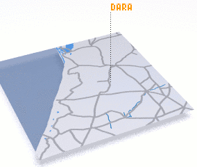 Places with similar names to Dara, Senegal ::
Disclaimer :: Information on this page comes without warranty of any kind |
||
|
Where is Dara? Elevation and coordinates ::
Latitude (lat): 15°31'0"N Longitude (lon): 16°19'0"W
Elevation (approx.): 35m (map arrows pan, magnifying glasses zoom) |
||
|
Visiting Dara? Hotel/Accommodation ::
Book a hotel in Dara Travel Guide ::
Buy a travel guide for Senegal rental cars ::
car rental offers GPS waypoint ::
download a GPX waypoint (PoI) of Dara for your GPS receiver
|
||