|
search place name
|
||
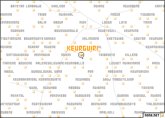
Keur Guiri (Louga, Senegal)Keur Guiri is a town in the Louga region of Senegal. An overview map of the region around Keur Guiri is displayed below.
regional and 3d topo map of Keur Guiri, Senegal ::
Keur Guiri airports ::
The nearest airport is XLS - St. Louis Saint Louis, located 59.3 km north of Keur Guiri.
Other airports nearby include KLC - Kaolack (157.0 km south), DKR - Dakar Leopold Sedar Senghor Intl (159.2 km south west), Nearby towns ::
Keur Mor Barama (1.8km east) //
Keur Demba (1.9km south) //
Kel (2.6km north west) //
Keur Mballo (2.6km south west) //
Beul (2.6km north east) //
Ndiéri (3.6km west) //
Ndam Gott (4.1km north west) //
Vélingara (4.1km north east) //
Badèm (4.1km north east) //
Par (4.1km south east) //
Kara (4.0km north west) //
Boiti (4.0km north west) //
Tiïl (4.0km north east) //
Dangourou (5.1km south west) //
Taïba Sèye (5.4km east) //
Nguimbou (5.6km south) //
Kaïbé (5.7km east) //
Bidem (5.7km west) //
Diakhaté (6.5km south east) //
Nguèyène (6.5km north west) //
Boussourou Lo (6.6km north west) //
Dara (6.5km south west) //
Nièm (7.4km north) //
Nguène (7.4km west) //
Palène Sélédiane (7.4km west) //
Mbobou (7.6km south) //
Dagaït (7.6km north) //
Léguèt (7.4km east) //
Nguéye Dili (7.7km north east) //
[all distances 'as the bird flies' and approximate]  Places with similar names to Keur Guiri, Senegal ::
// Gourreguir (MA)
// Krakra (MA)
// Krakra (MA)
// Krakra (MA)
// Kriker (MA)
// Qarqar (AZ)
// Carcar (PH)
// Caraycaray (PH)
// Carigara (PH)
// Corcuera (PH)
Disclaimer :: Information on this page comes without warranty of any kind |
||
|
Where is Keur Guiri? Elevation and coordinates ::
Latitude (lat): 15°33'0"N Longitude (lon): 16°16'0"W
Elevation (approx.): 37m (map arrows pan, magnifying glasses zoom) |
||
|
Visiting Keur Guiri? Hotel/Accommodation ::
Book a hotel in Keur Guiri Travel Guide ::
Buy a travel guide for Senegal rental cars ::
car rental offers GPS waypoint ::
download a GPX waypoint (PoI) of Keur Guiri for your GPS receiver
|
||