|
search place name
|
||
Chivumba (Southern, Zambia)Chivumba is a town in the Southern region of Zambia. An overview map of the region around Chivumba is displayed below.
regional and 3d topo map of Chivumba, Zambia ::

Chivumba airports ::
The nearest airport is KAB - Kariba Intl, located 106.5 km east of Chivumba.
Other airports nearby include LUN - Lusaka Intl (129.0 km north east), Nearby towns ::
Musende (2.6km south west) //
Chilemba (3.6km east) //
Bwantu (5.6km north) //
Mwanamambo (5.6km south) //
Namachila (5.6km east) //
Mungolo (6.5km north east) //
Muchanta (7.4km east) //
Siabusha (8.2km south east) //
Ngangula (8.2km south east) //
Nadongo (8.0km north west) //
[all distances 'as the bird flies' and approximate] 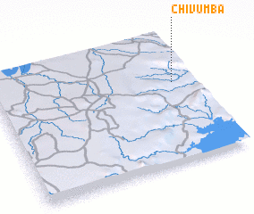 Places with similar names to Chivumba, Zambia ::
// Shavuma (CD)
// Shifuma (CD)
// Siafoumou (CG)
// Chefamuai (TP)
// Chavuma (ZM)
// Chivimba (ZM)
// Chefe Aiamo (MZ)
// Chefe Mauai (MZ)
// Chefe Meia (MZ)
// Chefe Moeia (MZ)
Disclaimer :: Information on this page comes without warranty of any kind |
||
|
Where is Chivumba? Elevation and coordinates ::
Latitude (lat): 16°22'0"S Longitude (lon): 27°54'0"E
Elevation (approx.): 913m (map arrows pan, magnifying glasses zoom) |
||
|
Visiting Chivumba? Hotel/Accommodation ::
Book a hotel in Chivumba Travel Guide ::
Buy a travel guide for Zambia rental cars ::
car rental offers GPS waypoint ::
download a GPX waypoint (PoI) of Chivumba for your GPS receiver
|
||