|
search place name
|
||
Bangema (Southern, Sierra Leone)Bangema is a town in the Southern region of Sierra Leone. An overview map of the region around Bangema is displayed below.
regional and 3d topo map of Bangema, Sierra Leone ::

Bangema airports ::
The nearest airport is FNA - Freetown Lungi, located 182.8 km north west of Bangema.
Other airports nearby include MLW - Monrovia Spriggs Payne (206.3 km south east), ROB - Monrovia Roberts Intl (236.2 km south east), Nearby towns ::
Gawura (1.5km west) //
Bawura (1.9km north) //
Gerehun (2.6km south west) //
Konima (2.6km north east) //
Samabobu (2.6km south east) //
Kendiama (4.1km north west) //
Sembehun (4.1km south west) //
Kanga (5.9km north) //
Dodo (6.6km south west) //
Bandajuma (6.7km north east) //
Tungie (6.6km south east) //
Mesima (6.7km north west) //
Jahandama (7.0km east) //
Mina (7.3km east) //
Masakpa (7.3km west) //
Jagbakahun (7.6km north) //
Kakpwema (7.6km west) //
Mamboma (8.0km south east) //
Juma (8.2km south east) //
Magbwema (8.3km south west) //
Lembima (8.3km south west) //
Bo (8.3km north west) //
Nyandehun (8.4km north east) //
Towama (8.5km west) //
Gangama (9.2km north) //
Kigbai (9.8km south west) //
Nagbema (10.4km south east) //
[all distances 'as the bird flies' and approximate] 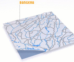 Places with similar names to Bangema, Sierra Leone ::
Disclaimer :: Information on this page comes without warranty of any kind |
||
|
Where is Bangema? Elevation and coordinates ::
Latitude (lat): 7°54'0"N Longitude (lon): 11°42'0"W
Elevation (approx.): 88m (map arrows pan, magnifying glasses zoom) |
||
|
Visiting Bangema? Hotel/Accommodation ::
Book a hotel in Bangema Travel Guide ::
rental cars ::
car rental offers GPS waypoint ::
download a GPX waypoint (PoI) of Bangema for your GPS receiver
|
||