|
search place name
|
||
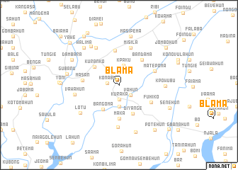
Blama (Southern, Sierra Leone)Blama is a town in the Southern region of Sierra Leone. An overview map of the region around Blama is displayed below.
regional and 3d topo map of Blama, Sierra Leone ::
Blama airports ::
The nearest airport is MLW - Monrovia Spriggs Payne, located 151.8 km south east of Blama.
Other airports nearby include ROB - Monrovia Roberts Intl (186.9 km south east), FNA - Freetown Lungi (222.1 km north west), Nearby towns ::
Konabu (1.8km west) //
Kuraka (2.3km south) //
Sahun (2.4km south east) //
Vahun (2.4km south east) //
Kpaku (3.2km north) //
Ngorgo (3.4km south) //
Bangoma (4.6km south west) //
Kuranko (4.8km north west) //
Diyange (5.0km south east) //
Maka (5.3km south) //
Bandama (5.4km north east) //
Makoma (5.4km north) //
Fuhiko (5.7km south east) //
Masan (5.7km west) //
Matepoma (5.9km east) //
Misila (6.1km north) //
Sahun (6.6km south) //
Nyandehun (6.9km north west) //
Vawahun (7.1km west) //
Kpowubu (7.2km east) //
Bobobu (7.5km north west) //
Lotu (7.5km south west) //
Kpasumba (7.9km south) //
Masipema (7.9km north) //
Walima (8.0km north west) //
Dambara (8.3km north west) //
Gubaru (8.4km west) //
Senehun (8.7km south east) //
Potehun (9.0km south east) //
[all distances 'as the bird flies' and approximate] 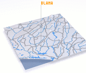 Places with similar names to Blama, Sierra Leone ::
Disclaimer :: Information on this page comes without warranty of any kind |
||
|
Where is Blama? Elevation and coordinates ::
Latitude (lat): 7°20'51"N Longitude (lon): 11°38'1"W
Elevation (approx.): 42m (map arrows pan, magnifying glasses zoom) |
||
|
Visiting Blama? Hotel/Accommodation ::
Book a hotel in Blama Travel Guide ::
rental cars ::
car rental offers GPS waypoint ::
download a GPX waypoint (PoI) of Blama for your GPS receiver
|
||