|
search place name
|
||
Tamful (Southern, Sierra Leone)Tamful is a town in the Southern region of Sierra Leone. An overview map of the region around Tamful is displayed below.
regional and 3d topo map of Tamful, Sierra Leone ::

Tamful airports ::
The nearest airport is FNA - Freetown Lungi, located 132.4 km north west of Tamful.
Other airports nearby include MLW - Monrovia Spriggs Payne (248.9 km south east), Nearby towns ::
Goabu (3.5km west) //
Sembehun (4.7km west) //
Pujehun (6.5km east) //
Mokombi (6.6km south east) //
Mogbago (7.1km north west) //
Pekam (7.2km north) //
Nyandehun (7.5km north) //
Gbie (8.0km south west) //
Sahama (8.1km north west) //
Periwahun (8.4km east) //
Bemebu (8.7km east) //
Fakaisana (8.8km south) //
Polbo (8.8km south east) //
Bambe (9.3km south east) //
Konolo (9.6km north west) //
Giehun (11.5km south east) //
[all distances 'as the bird flies' and approximate] 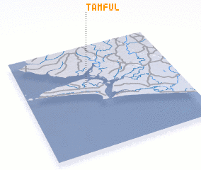 Places with similar names to Tamful, Sierra Leone ::
// Diamveli (SN)
// Diamvéli (SN)
// Timbafoulou (SN)
// Tomaval (PE)
// Tomba Foulah (GN)
// Tambafoulou (ML)
// Tombavil (PG)
// Tomvalle (NI)
// Démouville (FR)
// Damville (FR)
Disclaimer :: Information on this page comes without warranty of any kind |
||
|
Where is Tamful? Elevation and coordinates ::
Latitude (lat): 7°34'19"N Longitude (lon): 12°36'32"W
Elevation (approx.): 16m (map arrows pan, magnifying glasses zoom) |
||
|
Visiting Tamful? Hotel/Accommodation ::
Book a hotel in Tamful Travel Guide ::
rental cars ::
car rental offers GPS waypoint ::
download a GPX waypoint (PoI) of Tamful for your GPS receiver
|
||