|
search place name
|
||
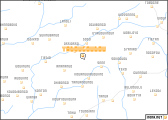
Yadougoudou (Cote d'Ivoire)Yadougoudou is a town in Cote d'Ivoire. An overview map of the region around Yadougoudou is displayed below.
regional and 3d topo map of Yadougoudou, Cote d'Ivoire ::
Yadougoudou airports ::
The nearest airport is NYI - Sunyani, located 113.3 km south east of Yadougoudou.
Other airports nearby include BYK - Bouake (206.2 km west), Nearby towns ::
Aguinda (2.8km north west) //
Sogo (3.8km north) //
Assiasso (4.0km north west) //
Sépé (4.0km east) //
Kouamédiadoukro (4.3km south) //
Amarando (4.9km south west) //
Tangamourou (5.9km south) //
Dyadoukroum (6.7km north east) //
Aguibango (7.6km north east) //
Ahi Bango (7.8km south west) //
Sokoadou (7.8km east) //
Tiédio (8.4km west) //
Lamoli (8.8km north west) //
Sékré-Bango (9.0km north west) //
Téko (9.0km east) //
[all distances 'as the bird flies' and approximate] 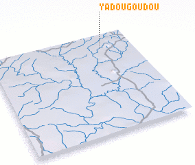
Disclaimer :: Information on this page comes without warranty of any kind |
||
|
Where is Yadougoudou? Elevation and coordinates ::
Latitude (lat): 7°53'13"N Longitude (lon): 3°12'36"W
Elevation (approx.): 282m (map arrows pan, magnifying glasses zoom) |
||
|
Visiting Yadougoudou? Hotel/Accommodation ::
Book a hotel in Yadougoudou Travel Guide ::
rental cars ::
car rental offers GPS waypoint ::
download a GPX waypoint (PoI) of Yadougoudou for your GPS receiver
|
||