|
search place name
|
||
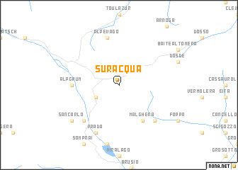
Suracqua (Aargau, Switzerland)Suracqua is a town in the Aargau region of Switzerland. An overview map of the region around Suracqua is displayed below.
regional and 3d topo map of Suracqua, Switzerland ::
Suracqua airports ::
The nearest airport is SMV - Samedan, located 23.6 km north west of Suracqua.
Other airports nearby include BGY - Bergamo Orio Al Serio (84.6 km south), BZO - Bolzano (94.7 km east), LUG - Lugano (101.0 km south west), VBS - Montichiari (107.6 km south), Nearby towns ::
Angeli Custodi (3.2km south west) //
La Rösa (3.2km north west) //
Malghera (6.1km south east) //
Alp Grüm (5.1km west) //
Alpe Vago (7.5km north) //
Poschiavo (6.8km south west) //
Campo Pedrona (6.8km south east) //
Prada (7.8km south) //
San Carlo (7.6km south west) //
[all distances 'as the bird flies' and approximate]  Places with similar names to Suracqua, Switzerland ::
// Siricucu (BR)
// Cerro Gago (PA)
// Sirakaíika (GR)
// Sierakówko (PL)
// Sarıkoç (TR)
// Sarıkoç (TR)
// Sirkeköy (TR)
// Sürgüç (TR)
// Sürgücü (TR)
// Zariquiegui (ES)
Disclaimer :: Information on this page comes without warranty of any kind |
||
|
Where is Suracqua? Elevation and coordinates ::
Latitude (lat): 46°23'0"N Longitude (lon): 10°6'0"E
Elevation (approx.): 2001m (map arrows pan, magnifying glasses zoom) |
||
|
Visiting Suracqua? Hotel/Accommodation ::
Book a hotel in Suracqua Travel Guide ::
Buy a travel guide for Switzerland rental cars ::
car rental offers GPS waypoint ::
download a GPX waypoint (PoI) of Suracqua for your GPS receiver
|
||