|
search place name
|
||
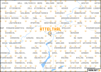
Attelthal (Bayern, Germany)Attelthal is a town in the Bayern region of Germany. An overview map of the region around Attelthal is displayed below.
regional and 3d topo map of Attelthal, Germany ::
Attelthal airports ::
The nearest airport is MUC - Munich Munchen, located 47.0 km north west of Attelthal.
Other airports nearby include OBF - Oberpfaffenhofen (66.3 km west), SZG - Salzburg (67.4 km east), FEL - Fuerstenfeldbruck Furstenfeldbruck (70.2 km west), AGB - Augsburg (102.4 km north west), Nearby towns ::
Sendling (0.0km north) //
Attel (1.2km east) //
Allmannsberg (1.9km north) //
Roßhart (1.9km north) //
Ramerberg (1.2km west) //
Katzbach (1.9km south) //
Limburg (2.2km north east) //
Kornberg (2.2km north east) //
Griesstätt (2.2km south east) //
Hart (2.2km north west) //
Zainach (2.2km south west) //
Berg (2.2km south west) //
Breitbrunn (3.7km north) //
Kerschdorf (2.5km east) //
Laiming (2.5km east) //
Wechselberg (3.7km south) //
Weng (3.7km south) //
Viehhausen (3.9km north) //
Freiham (3.1km north east) //
Hausmehring (3.1km north east) //
Bergham (3.1km south east) //
Raming (3.1km south east) //
Straß (3.1km south east) //
Kettenham (3.1km south east) //
Graben (3.1km north west) //
Zellerreit (3.1km north west) //
Goßmaning (3.9km south) //
Haid (3.9km south) //
Leiten (3.1km south west) //
[all distances 'as the bird flies' and approximate]  Places with similar names to Attelthal, Germany :: Disclaimer :: Information on this page comes without warranty of any kind |
||
|
Where is Attelthal? Elevation and coordinates ::
Latitude (lat): 48°1'0"N Longitude (lon): 12°10'0"E
Elevation (approx.): 428m (map arrows pan, magnifying glasses zoom) |
||
|
Visiting Attelthal? Hotel/Accommodation ::
Book a hotel in Attelthal Travel Guide ::
Buy a travel guide for Germany rental cars ::
car rental offers GPS waypoint ::
download a GPX waypoint (PoI) of Attelthal for your GPS receiver
|
||