|
search place name
|
||
Dottendorf (Nordrhein-Westfalen, Germany)Dottendorf is a town in the Nordrhein-Westfalen region of Germany. An overview map of the region around Dottendorf is displayed below.
regional and 3d topo map of Dottendorf, Germany ::

nearby GPS traces from timatio ::
Dottendorf airports ::
The nearest airport is CGN - Cologne Koln Bonn, located 18.5 km north of Dottendorf.
Other airports nearby include ZNV - Koblenz Winningen (50.9 km south east), DUS - Duesseldorf Dusseldorf (70.0 km north), MGL - Moenchengladbach Monchengladbach (73.0 km north west), ESS - Essen Mulheim (79.1 km north), Nearby towns ::
Friesdorf (2.2km south east) //
Kessenich (2.2km north west) //
Poppelsdorf (2.2km north west) //
Plittersdorf (2.3km east) //
Venusberg (2.3km west) //
Ippendorf (2.3km west) //
Ückesdorf (2.3km west) //
Limperich (3.9km north) //
Beuel (3.9km north) //
Bonn (3.9km north) //
Ramersdorf (3.0km north east) //
Bad Godesberg (3.0km south east) //
Küdinghoven (4.4km north east) //
Schwarz Rheindorf (5.6km north) //
Pech (5.6km south) //
Vilich-Müldorf (5.7km north) //
Vilich Rheindorf (5.7km north) //
Vilich (5.7km north) //
Lengsdorf (4.0km north west) //
Oberkassel (4.0km north east) //
Röttgen (4.0km south west) //
Rüngsdorf (4.0km south east) //
Endenich (5.1km north west) //
Bechlinghoven (6.0km north east) //
Pützchen (6.0km north east) //
Lannesdorf (5.1km south east) //
Muffendorf (5.1km south east) //
Ließem (6.0km south east) //
Oberdollendorf (4.7km east) //
[all distances 'as the bird flies' and approximate] 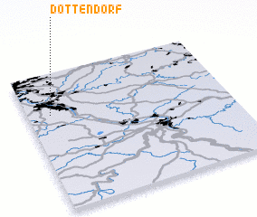 Places with similar names to Dottendorf, Germany ::
// Duttendorf (AT)
// Tautendorf (AT)
// Tautendorf (AT)
// Tautendorf (AT)
// Tattendorf (AT)
// Tottendorf (AT)
// Dedendorf (DE)
// Dettendorf (DE)
// Dettendorf (DE)
// Dietendorf (DE)
Disclaimer :: Information on this page comes without warranty of any kind |
||
|
Where is Dottendorf? Elevation and coordinates ::
Latitude (lat): 50°42'0"N Longitude (lon): 7°7'0"E
Elevation (approx.): 61m (map arrows pan, magnifying glasses zoom) |
||
|
Visiting Dottendorf? Hotel/Accommodation ::
Book a hotel in Dottendorf Travel Guide ::
Buy a travel guide for Germany rental cars ::
car rental offers GPS waypoint ::
download a GPX waypoint (PoI) of Dottendorf for your GPS receiver
|
||