|
search place name
|
||
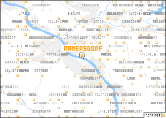
Ramersdorf (Nordrhein-Westfalen, Germany)Ramersdorf is a town in the Nordrhein-Westfalen region of Germany. An overview map of the region around Ramersdorf is displayed below.
regional and 3d topo map of Ramersdorf, Germany ::
nearby GPS traces from timatio ::
Ramersdorf airports ::
The nearest airport is CGN - Cologne Koln Bonn, located 16.6 km north of Ramersdorf.
Other airports nearby include ZNV - Koblenz Winningen (51.1 km south east), DUS - Duesseldorf Dusseldorf (69.2 km north west), MGL - Moenchengladbach Monchengladbach (72.9 km north west), ESS - Essen Mulheim (77.7 km north), Nearby towns ::
Küdinghoven (1.9km north) //
Plittersdorf (1.9km south) //
Oberkassel (1.2km east) //
Limperich (2.2km north west) //
Beuel (2.2km north west) //
Römlinghoven (2.3km east) //
Pützchen (3.7km north) //
Bechlinghoven (3.7km north) //
Bad Godesberg (3.7km south) //
Gielgen (3.0km north east) //
Niederholtorf (3.0km north east) //
Roleber (3.0km north east) //
Oberdollendorf (3.0km south east) //
Dottendorf (3.0km south west) //
Hangelar (3.9km north) //
Vilich (3.9km north) //
Kohlkaul (3.9km north) //
Vilich-Müldorf (3.9km north) //
Vilich Rheindorf (3.9km north) //
Rüngsdorf (3.9km south) //
Friesdorf (3.9km south) //
Holzlar (4.4km north east) //
Niederberg (4.4km north east) //
Schwarz Rheindorf (4.4km north west) //
Königswinter (4.4km south east) //
Niederdollendorf (4.4km south east) //
Vinxel (3.5km east) //
Kessenich (3.5km west) //
Poppelsdorf (3.5km west) //
[all distances 'as the bird flies' and approximate]  Places with similar names to Ramersdorf, Germany ::
// Ramersdorf (AT)
// Rammersdorf (AT)
// Rammersdorf (AT)
// Rammerstorf (AT)
// Römersdorf (AT)
// Rumersdorf (AT)
// Rumerstorf (AT)
// Ramersdorf (DE)
// Ramersdorf (DE)
// Ramersdorf (DE)
Disclaimer :: Information on this page comes without warranty of any kind |
||
|
Where is Ramersdorf? Elevation and coordinates ::
Latitude (lat): 50°43'0"N Longitude (lon): 7°9'0"E
Elevation (approx.): 52m (map arrows pan, magnifying glasses zoom) |
||
|
Visiting Ramersdorf? Hotel/Accommodation ::
Book a hotel in Ramersdorf Travel Guide ::
Buy a travel guide for Germany rental cars ::
car rental offers GPS waypoint ::
download a GPX waypoint (PoI) of Ramersdorf for your GPS receiver
|
||