|
search place name
|
||
Langenfeld (Bayern, Germany)Langenfeld is a town in the Bayern region of Germany. An overview map of the region around Langenfeld is displayed below.
regional and 3d topo map of Langenfeld, Germany ::

Langenfeld airports ::
The nearest airport is GHF - Giebelstadt Aaf, located 39.9 km west of Langenfeld.
Other airports nearby include NUE - Nuernberg Nurnberg (41.9 km east), BYU - Bayreuth (90.5 km north east), HOQ - Hof Plauen (121.7 km north east), ZNF - Hanau Aaf (127.5 km north west), Nearby towns ::
Baudenbach (1.2km east) //
Hambühl (1.2km east) //
Frankenfeld (2.2km north west) //
Hohenholz (2.2km south east) //
Holzberndorf (2.2km south east) //
Ullstadt (2.4km west) //
Unternesselbach (3.7km south) //
Ruthmannsweiler (3.9km north) //
Diebach (3.0km south east) //
Unterlaimbach (3.0km north west) //
Oberlaimbach (3.0km north west) //
Kleingressingen (4.4km north west) //
Virnsbergerhaag (4.4km south east) //
Obernesselbach (4.4km south west) //
Lerchenhöchstadt (5.7km north) //
Lachheim (5.7km north) //
Höfen (4.1km north east) //
Dietersheim (5.7km south) //
Hasenlohe (5.7km south) //
Buchhof (4.1km south west) //
Obersteinbach (6.1km north east) //
Mönchsberg (5.2km north east) //
Wilhelminenberg (6.1km north east) //
Roßbach (5.2km north east) //
Hohlweiler (5.2km north west) //
Oberroßbach (6.1km south east) //
Klosterdorf (6.1km north west) //
Birkenfeld (5.2km south east) //
Hausenhof (6.1km south west) //
[all distances 'as the bird flies' and approximate] 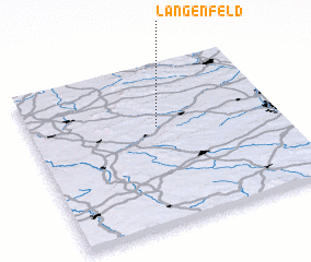 Places with similar names to Langenfeld, Germany ::
// Lengenfeld (AT)
// Langenfelde (DE)
// Langenfelde (DE)
// Langenfeld (DE)
// Langenfeld (DE)
// Langenfeld (DE)
// Langenfeld (DE)
// Langenfelde (DE)
// Langenfelde (DE)
// Lengenfeld (DE)
Disclaimer :: Information on this page comes without warranty of any kind |
||
|
Where is Langenfeld? Elevation and coordinates ::
Latitude (lat): 49°37'0"N Longitude (lon): 10°31'0"E
Elevation (approx.): 295m (map arrows pan, magnifying glasses zoom) |
||
|
Visiting Langenfeld? Hotel/Accommodation ::
Book a hotel in Langenfeld Travel Guide ::
Buy a travel guide for Germany rental cars ::
car rental offers GPS waypoint ::
download a GPX waypoint (PoI) of Langenfeld for your GPS receiver
|
||