|
search place name
|
||
Sankt Stephan (Bayern, Germany)Sankt Stephan is a town in the Bayern region of Germany. An overview map of the region around Sankt Stephan is displayed below.
regional and 3d topo map of Sankt Stephan, Germany ::

Sankt Stephan airports ::
The nearest airport is AGB - Augsburg, located 7.4 km south east of Sankt Stephan.
Other airports nearby include FEL - Fuerstenfeldbruck Furstenfeldbruck (42.0 km south east), OBF - Oberpfaffenhofen (53.6 km south east), MUC - Munich Munchen (68.4 km east), NUE - Nuernberg Nurnberg (113.7 km north), Nearby towns ::
Stettenhofen (2.2km south west) //
Langweid (2.5km west) //
Sand (4.4km north east) //
Scherneck (3.7km east) //
Oberach (3.7km east) //
Rehling (3.7km east) //
Au (3.7km east) //
Unterach (3.7km east) //
Anwalting (4.1km south east) //
Eisenbrechtshofen (4.1km north west) //
Eggelhof (4.1km north west) //
Herbertshofen (6.1km north west) //
Todtenweis (5.2km north east) //
Bach (6.1km north east) //
Gersthofen (7.4km south) //
Achsheim (4.9km west) //
Allmering (4.9km east) //
Ostendorf (7.5km north) //
Mühlhausen (6.7km south east) //
Ehekirchen (6.7km north west) //
Erlingen (6.7km north west) //
Gablingen (6.2km south west) //
Biberbach (6.2km north west) //
Meitingen (7.8km north) //
Aindling (6.2km north east) //
Hirblingen (7.4km south west) //
Batzenhofen (7.4km south west) //
Holzhausen (7.4km south west) //
Bergen (7.4km south east) //
[all distances 'as the bird flies' and approximate] 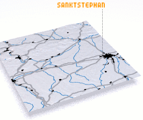 Places with similar names to Sankt Stephan, Germany ::
// Sankt Stephan (CH)
// Sankt Stefan (AT)
// Sankt Stefan (AT)
// Sankt Stefan (AT)
// Sankt Stefan (AT)
// Sankt Stefan (AT)
// Sankt Stefan (AT)
// Sankt Stefan (AT)
// Sankt Stephan (DE)
// Sankt Stefan (AT)
Disclaimer :: Information on this page comes without warranty of any kind |
||
|
Where is Sankt Stephan? Elevation and coordinates ::
Latitude (lat): 48°29'0"N Longitude (lon): 10°53'0"E
Elevation (approx.): 447m (map arrows pan, magnifying glasses zoom) |
||
|
Visiting Sankt Stephan? Hotel/Accommodation ::
Book a hotel in Sankt Stephan Travel Guide ::
Buy a travel guide for Germany rental cars ::
car rental offers GPS waypoint ::
download a GPX waypoint (PoI) of Sankt Stephan for your GPS receiver
|
||