|
search place name
|
||
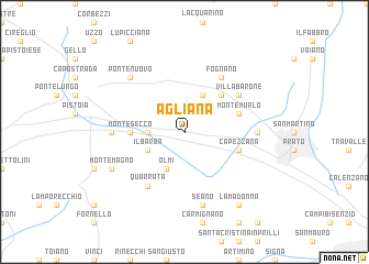
Agliana (Italy)Agliana is a town in Italy. An overview map of the region around Agliana is displayed below.
regional and 3d topo map of Agliana, Italy ::
Agliana airports ::
The nearest airport is FLR - Firenze, located 19.3 km south east of Agliana.
Other airports nearby include PSA - Pisa (54.5 km south west), BLQ - Bologna (74.3 km north), SAY - Siena Ampugnano (74.4 km south), FRL - Forli (91.8 km east), Nearby towns ::
Colombaie (2.7km west) //
Olmi (3.9km south) //
Il Barba (3.3km south west) //
Montale (3.9km north) //
Fornacelle (4.6km north east) //
Montesecco (4.0km west) //
Capezzana (4.4km south east) //
Montemurlo (4.4km north east) //
Quarrata (6.2km south west) //
Villa Barone (5.5km north east) //
Fognano (6.2km north east) //
Maliseti (5.3km east) //
Fedi (5.3km west) //
Seano (7.5km south) //
Ponte Nuovo (6.9km north west) //
Montemagno (6.5km south west) //
La Madonna (8.4km south east) //
[all distances 'as the bird flies' and approximate] 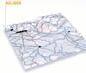 Places with similar names to Agliana, Italy ::
Disclaimer :: Information on this page comes without warranty of any kind |
||
|
Where is Agliana? Elevation and coordinates ::
Latitude (lat): 43°54'0"N Longitude (lon): 11°0'0"E
Elevation (approx.): 43m (map arrows pan, magnifying glasses zoom) |
||
|
Visiting Agliana? Hotel/Accommodation ::
Book a hotel in Agliana Travel Guide ::
Buy a travel guide for Italy rental cars ::
car rental offers GPS waypoint ::
download a GPX waypoint (PoI) of Agliana for your GPS receiver
|
||