|
search place name
|
||
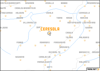
Ceresola (Italy)Ceresola is a town in Italy. An overview map of the region around Ceresola is displayed below.
regional and 3d topo map of Ceresola, Italy ::
Ceresola airports ::
The nearest airport is PMF - Parma, located 57.7 km north of Ceresola.
Other airports nearby include BLQ - Bologna (64.2 km east), PSA - Pisa (73.0 km south), FLR - Firenze (79.2 km south east), QPZ - Piacenza (91.0 km north west), Nearby towns ::
Romanoro (3.9km south) //
Quara (3.2km north west) //
Frassinoro (4.6km south east) //
Cervarolo (5.4km south west) //
Toano (6.2km north east) //
Cavola (7.4km north) //
Casola (5.3km east) //
Braglie (7.5km south) //
Riccovolto (7.5km south) //
Tolaro (5.6km east) //
Spervara (6.8km south east) //
Cargedolo (7.9km south) //
Villa Minozzo (6.5km north west) //
Massa (7.7km north east) //
[all distances 'as the bird flies' and approximate]  Places with similar names to Ceresola, Italy ::
// Şorsulu (AZ)
// Şorsulu (AZ)
// Xoruzlu (AZ)
// Zarıslı (AZ)
// Sarcillo (US)
// Cerrezuela (PA)
// Cerro Azul (PA)
// Cerro Azul (PA)
// Cerasola (IT)
// Cerasolo (IT)
Disclaimer :: Information on this page comes without warranty of any kind |
||
|
Where is Ceresola? Elevation and coordinates ::
Latitude (lat): 44°20'0"N Longitude (lon): 10°32'0"E
Elevation (approx.): 654m (map arrows pan, magnifying glasses zoom) |
||
|
Visiting Ceresola? Hotel/Accommodation ::
Book a hotel in Ceresola Travel Guide ::
Buy a travel guide for Italy rental cars ::
car rental offers GPS waypoint ::
download a GPX waypoint (PoI) of Ceresola for your GPS receiver
|
||