|
search place name
|
||
Quara (Italy)Quara is a town in Italy. An overview map of the region around Quara is displayed below.
regional and 3d topo map of Quara, Italy ::

Quara airports ::
The nearest airport is PMF - Parma, located 55.2 km north of Quara.
Other airports nearby include BLQ - Bologna (66.1 km east), PSA - Pisa (74.5 km south), FLR - Firenze (82.4 km south east), QPZ - Piacenza (87.8 km north west), Nearby towns ::
Villa Minozzo (3.2km north west) //
Ceresola (3.2km south east) //
Romanoro (5.7km south) //
Cervarolo (5.7km south) //
Cavola (6.2km north east) //
Poiano (6.5km north west) //
Toano (6.5km north east) //
Vologno (7.7km north west) //
Casale di Bismantova (8.4km north west) //
Frassinoro (7.7km south east) //
Febbio (7.7km south west) //
[all distances 'as the bird flies' and approximate] 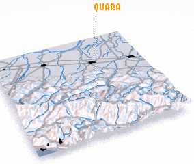 Places with similar names to Quara, Italy ::
Disclaimer :: Information on this page comes without warranty of any kind |
||
|
Where is Quara? Elevation and coordinates ::
Latitude (lat): 44°21'0"N Longitude (lon): 10°30'0"E
Elevation (approx.): 774m (map arrows pan, magnifying glasses zoom) |
||
|
Visiting Quara? Hotel/Accommodation ::
Book a hotel in Quara Travel Guide ::
Buy a travel guide for Italy rental cars ::
car rental offers GPS waypoint ::
download a GPX waypoint (PoI) of Quara for your GPS receiver
|
||