|
search place name
|
||
SantʼIsidoro (Italy)SantʼIsidoro is a town in Italy. An overview map of the region around SantʼIsidoro is displayed below.
regional and 3d topo map of SantʼIsidoro, Italy ::

SantʼIsidoro airports ::
The nearest airport is PEG - Perugia, located 87.1 km west of SantʼIsidoro.
Other airports nearby include PSR - Pescara (88.9 km south east), RMI - Rimini (128.9 km north west), CIA - Rome Ciampino (165.8 km south west), FRL - Forli (172.3 km north west), Nearby towns ::
Grottazzolina (1.4km east) //
Magliano di Tenna (3.9km north) //
Monte Giberto (3.3km south east) //
Monsampietro Morico (4.6km south west) //
Rapagnano (5.6km north) //
San Lorenzo (5.6km south) //
Montottone (5.7km south) //
Belmonte Piceno (4.5km south west) //
Ponzano di Fermo (4.5km south east) //
Montegiorgio (5.5km north west) //
Torre San Patrizio (7.5km north) //
Ortezzano (7.5km south) //
SantʼElpidio Morico (7.9km south) //
Petritoli (6.6km south east) //
[all distances 'as the bird flies' and approximate] 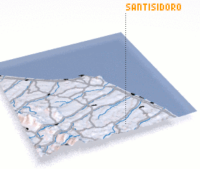 Places with similar names to SantʼIsidoro, Italy ::
// Santo Esidro (BR)
// Santo Isidoro (BR)
// Santo Isidro (BR)
// San Desiderio (IT)
// Santo Izidoro (PT)
// Santo Izidro (PT)
// Saint Isidore (ZA)
// Saint-Isidore (ML)
// Saint-Satur (FR)
// Saint-Astier (FR)
Disclaimer :: Information on this page comes without warranty of any kind |
||
|
Where is SantʼIsidoro? Elevation and coordinates ::
Latitude (lat): 43°6'0"N Longitude (lon): 13°35'0"E
Elevation (approx.): 178m (map arrows pan, magnifying glasses zoom) |
||
|
Visiting SantʼIsidoro? Hotel/Accommodation ::
Book a hotel in SantʼIsidoro Travel Guide ::
Buy a travel guide for Italy rental cars ::
car rental offers GPS waypoint ::
download a GPX waypoint (PoI) of SantʼIsidoro for your GPS receiver
|
||