|
search place name
|
||
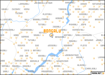
Bongalu (Grand Bassa, Liberia)Bongalu is a town in the Grand Bassa region of Liberia. An overview map of the region around Bongalu is displayed below.
regional and 3d topo map of Bongalu, Liberia ::
Bongalu airports ::
The nearest airport is ROB - Monrovia Roberts Intl, located 53.3 km west of Bongalu.
Other airports nearby include MLW - Monrovia Spriggs Payne (97.3 km west), Nearby towns ::
Tonabli (1.9km north) //
Besugabli (2.9km east) //
Zogabli (3.3km north east) //
Noyabli (3.4km west) //
Jessebli (3.7km south) //
Pobabli (4.1km north east) //
Totobli (5.2km north west) //
Boyubli (5.2km south east) //
Soubli (5.5km west) //
Noyabli (5.6km north) //
Diotabli (5.5km east) //
Charlie Johnson Town (5.8km east) //
Fabli (5.8km east) //
Boba Klebli (5.8km east) //
Zobabli (6.2km north west) //
Webubli (6.5km north east) //
Gue (6.7km south west) //
Charlie Johnsonbli (6.7km south east) //
Spedyva (6.7km south east) //
Sosibani (6.7km south east) //
Maulabli (6.7km north east) //
Bazin Section (7.4km south east) //
Ben Johnsonbli (7.4km south) //
Topo (7.4km south) //
Modebli (7.6km east) //
Mara Grand (7.6km west) //
Tutubli (7.6km west) //
Plefebli (7.6km north) //
Moncray (7.9km south) //
[all distances 'as the bird flies' and approximate] 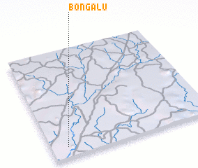 Places with similar names to Bongalu, Liberia ::
Disclaimer :: Information on this page comes without warranty of any kind |
||
|
Where is Bongalu? Elevation and coordinates ::
Latitude (lat): 6°6'0"N Longitude (lon): 9°54'0"W
Elevation (approx.): 206m (map arrows pan, magnifying glasses zoom) |
||
|
Visiting Bongalu? Hotel/Accommodation ::
Book a hotel in Bongalu Travel Guide ::
Buy a travel guide for Liberia rental cars ::
car rental offers GPS waypoint ::
download a GPX waypoint (PoI) of Bongalu for your GPS receiver
|
||