|
search place name
|
||
Kirkebæk (Viborg, Denmark)Kirkebæk is a town in the Viborg region of Denmark. An overview map of the region around Kirkebæk is displayed below.
regional and 3d topo map of Kirkebæk, Denmark ::

Kirkebæk airports ::
The nearest airport is KRP - Karup, located 24.9 km south west of Kirkebæk.
Other airports nearby include AAL - Aalborg (74.4 km north east), TED - Thisted (76.2 km north west), AAR - Aarhus (81.0 km east), STA - Stauning (82.6 km south west), Nearby towns ::
Rogenstrup (1.9km north) //
Løgstrup (2.1km north west) //
Romlund (2.0km west) //
Jegstrup (2.8km south west) //
Fiskbæk (2.8km north west) //
Vorde (5.6km north) //
Ravnstrup (4.8km south west) //
Gårsdal (5.9km south) //
Hjarbæk (5.9km north) //
Kølsen (5.9km north) //
Navntoft (4.5km north east) //
Viborg (6.4km south east) //
Kvols (6.4km north west) //
Agerskov (7.7km south) //
Nederhede (7.7km north) //
Finderup (8.0km south west) //
Øster Teglgård (6.9km south east) //
Skals (8.5km north east) //
[all distances 'as the bird flies' and approximate] 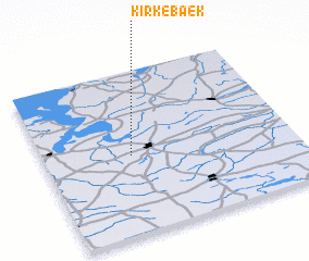 Places with similar names to Kirkebæk, Denmark ::
// Gürçubuk (TR)
// Karaçubuk (TR)
// Karagöbek (TR)
// Guérégabougou (ML)
// Karokobougou (ML)
// Kråkebäck (SE)
// Krokbäck (SE)
// Karakabak (CN)
// Kyrkbacka (FI)
// Carrickbeg (IE)
Disclaimer :: Information on this page comes without warranty of any kind |
||
|
Where is Kirkebæk? Elevation and coordinates ::
Latitude (lat): 56°29'0"N Longitude (lon): 9°21'0"E
Elevation (approx.): 26m (map arrows pan, magnifying glasses zoom) |
||
|
Visiting Kirkebæk? Hotel/Accommodation ::
Book a hotel in Kirkebæk Travel Guide ::
Buy a travel guide for Denmark rental cars ::
car rental offers GPS waypoint ::
download a GPX waypoint (PoI) of Kirkebæk for your GPS receiver
|
||