|
search place name
|
||
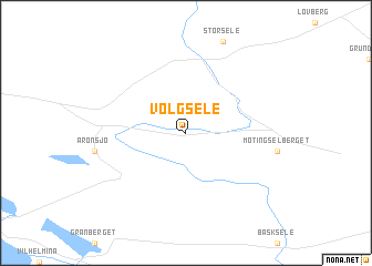
Volgsele (Västerbotten, Sweden)Volgsele is a town in the Västerbotten region of Sweden. An overview map of the region around Volgsele is displayed below.
regional and 3d topo map of Volgsele, Sweden ::
Volgsele airports ::
The nearest airport is VHM - Vilhelmina, located 17.4 km south of Volgsele.
Other airports nearby include LYC - Lycksele (94.7 km east), KRF - Kramfors Solleftea (193.9 km south), Nearby towns ::
[all distances 'as the bird flies' and approximate]  Places with similar names to Volgsele, Sweden ::
// Vŭlkosel (BG)
// Vilksala (LV)
// Valea Căşeiului (RO)
// Villouxel (FR)
// (( Veliko Selo )) (BA)
// Velʼke Selo (BY)
// Velʼke Sëlo (BY)
// Flaxley (AU)
// Viluksela (FI)
// Flaxley (GB)
Disclaimer :: Information on this page comes without warranty of any kind |
||
|
Where is Volgsele? Elevation and coordinates ::
Latitude (lat): 64°44'0"N Longitude (lon): 16°47'0"E
(map arrows pan, magnifying glasses zoom) |
||
|
Visiting Volgsele? Hotel/Accommodation ::
Book a hotel in Volgsele Travel Guide ::
Buy a travel guide for Sweden rental cars ::
car rental offers GPS waypoint ::
download a GPX waypoint (PoI) of Volgsele for your GPS receiver
|
||