|
search place name
|
||
Honkakylä (Etelä-Suomen Lääni, Finland)Honkakylä is a town in the Etelä-Suomen Lääni region of Finland. An overview map of the region around Honkakylä is displayed below.
regional and 3d topo map of Honkakylä, Finland ::

Honkakylä airports ::
The nearest airport is SVL - Savonlinna, located 54.6 km north west of Honkakylä.
Other airports nearby include JOE - Joensuu (111.5 km north), LPP - Lappeenranta (112.5 km south west), VRK - Varkaus (116.0 km north west), LED - St. Petersburg Pulkovo (209.5 km south), Nearby towns ::
Mikkolanniemi (2.1km north west) //
Tiitanvaara (3.7km south) //
Raikkala (2.6km west) //
Saari (3.2km south west) //
Tarnala (6.2km north west) //
Riihivaara (7.6km north) //
[all distances 'as the bird flies' and approximate] 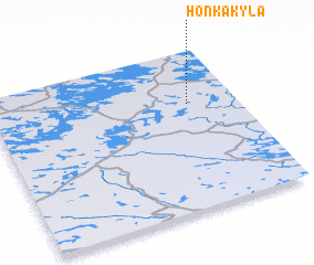 Places with similar names to Honkakylä, Finland ::
// Hinukgala (LK)
// Hanggae-gol (KP)
// Hongga-gol (KP)
// Hongŭi-gol (KP)
// Hung-k'u-liao (TW)
// Hongkeli (CN)
// Honkakylä (FI)
Disclaimer :: Information on this page comes without warranty of any kind |
||
|
Where is Honkakylä? Elevation and coordinates ::
Latitude (lat): 61°40'0"N Longitude (lon): 29°48'0"E
(map arrows pan, magnifying glasses zoom) |
||
|
Visiting Honkakylä? Hotel/Accommodation ::
Book a hotel in Honkakylä Travel Guide ::
Buy a travel guide for Finland rental cars ::
car rental offers GPS waypoint ::
download a GPX waypoint (PoI) of Honkakylä for your GPS receiver
|
||