|
search place name
|
||
Rearyvalley (Laois, Ireland)Rearyvalley is a town in the Laois region of Ireland. An overview map of the region around Rearyvalley is displayed below.
regional and 3d topo map of Rearyvalley, Ireland ::

Rearyvalley airports ::
The nearest airport is DUB - Dublin, located 85.0 km east of Rearyvalley.
Other airports nearby include GWY - Galway (98.9 km west), SNN - Shannon (110.7 km south west), WAT - Waterford (112.8 km south), NOC - Connaught (121.1 km north west), Nearby towns ::
Clonduff (1.5km north east) //
Clarahill (3.0km south) //
Gorteen Bridge (3.4km north) //
Moneyguid (3.3km north east) //
Rockfield (4.0km north) //
Cill Aichidh (4.8km north) //
Killeigh (4.8km north) //
Drummond (3.3km east) //
Longford (5.3km south) //
Hawkswood (5.8km north) //
Ballyclare Bridge (3.6km east) //
Clonaslee (4.3km south west) //
Cluain na Slí (4.3km south west) //
Srahcullen (4.9km south west) //
Derryclure (7.2km north) //
Kilmanman (4.5km west) //
Killeenmore (6.9km north) //
Rosenallis (6.3km south east) //
Glendineoregan (7.6km south west) //
Killurin (6.6km north west) //
Ballard (8.9km north) //
Derrylemoge (8.4km south east) //
[all distances 'as the bird flies' and approximate] 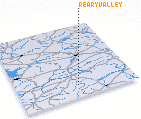
Disclaimer :: Information on this page comes without warranty of any kind |
||
|
Where is Rearyvalley? Elevation and coordinates ::
Latitude (lat): 53°10'22"N Longitude (lon): 7°28'30"W
Elevation (approx.): 85m (map arrows pan, magnifying glasses zoom) |
||
|
Visiting Rearyvalley? Hotel/Accommodation ::
Book a hotel in Rearyvalley Travel Guide ::
Buy a travel guide for Ireland rental cars ::
car rental offers GPS waypoint ::
download a GPX waypoint (PoI) of Rearyvalley for your GPS receiver
|
||