|
search place name
|
||
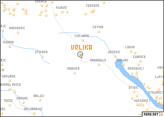
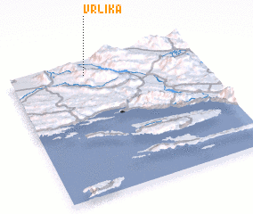
Vrlika (Croatia)Vrlika is a town in Croatia. An overview map of the region around Vrlika is displayed below.
regional and 3d topo map of Vrlika, Croatia ::
Vrlika airports ::
The nearest airport is SPU - Split, located 42.3 km south of Vrlika.
Other airports nearby include ZAD - Zadar (87.1 km west), OMO - Mostar (136.2 km south east), SJJ - Sarajevo (155.6 km east), ZAG - Zagreb (205.1 km north), Nearby towns ::
 Places with similar names to Vrlika, Croatia ::
// Frielick (DE)
// Ferry Lake (US)
// Verilaíika (GR)
// Fârliug (RO)
// Varlık (TR)
// Verlook (UA)
// Ferry Lake (US)
// Phurlak (IN)
// Faralako (GN)
// Vrhloga (SI)
Disclaimer :: Information on this page comes without warranty of any kind |
||
|
Where is Vrlika? Elevation and coordinates ::
Latitude (lat): 43°54'45"N Longitude (lon): 16°23'56"E
Elevation (approx.): 415m (map arrows pan, magnifying glasses zoom) |
||
|
Visiting Vrlika? Hotel/Accommodation ::
Book a hotel in Vrlika Travel Guide ::
Buy a travel guide for Croatia rental cars ::
car rental offers GPS waypoint ::
download a GPX waypoint (PoI) of Vrlika for your GPS receiver
|
||